Economic Revitalization Project · France

ZFU Hauts de Garonne Active
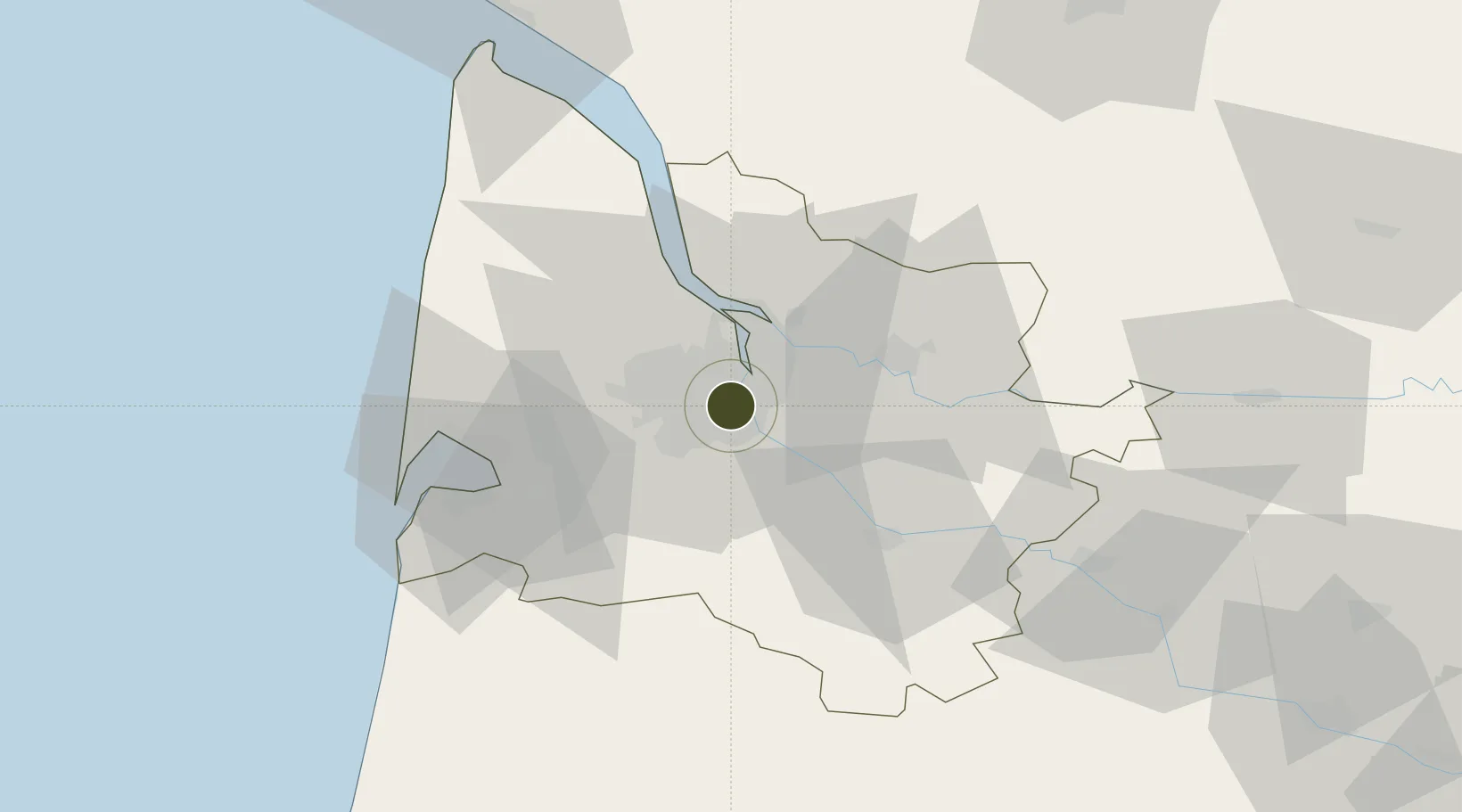
44.8292°, -0.5770°
864 ha
Zone area
4.2 km
Nearest port
10.9 km
Nearest airport

Gateway access

Nearest neighbours — logibook spatial index (haversine) over the source coordinates

Zone profile

Zone type
Economic Revitalization Project
Open Zone Map
Region
Gironde
Open Zone Map
Status
Active
Open Zone Map
Management
Public
Open Zone Map
Operator
Bordeaux, Cenon, Floirac et Lormont
Open Zone Map
Legal framework
Décret no 65-939 du 8 novembre 1965, Décret du 9 Octobre 2008
Open Zone Map

Location

Location of ozm-2023
Natural Earth 10m (public domain) · Gironde · ozm-2023 · 44.83, -0.58GoogleOSMYandex

Nearby Logistics Neighbours

Ports
  1. 1Bordeaux4 km
  2. 2Ambes21 km
  3. 3Blaye35 km
  4. 4Pauillac43 km
  5. 5Le Verdon88 km
Nearest neighbours — logibook spatial index (haversine) over the source coordinates
Airports
  1. 1Bordeaux–Mérignac Airport11 km
  2. 2Aérodrome d'Arcachon-La Teste-de-Buch50 km
  3. 3Cazaux (BA 120) Air Base54 km
  4. 4Bergerac Dordogne-Périgord airport86 km
  5. 5Royan-Médis Airport94 km
Nearest neighbours — logibook spatial index (haversine) over the source coordinates
Cities
  1. 1la Bastide/Bordeaux3 km
  2. 2Cenon4 km
  3. 3Bouliac5 km
  4. 4Le Bouscat5 km
  5. 5Hourcade6 km
Nearest neighbours — logibook spatial index (haversine) over the source coordinates
Trade Zones
  1. 1Port de Bordeaux10 km
  2. 2ZFU La Rochelle156 km
  3. 3Depósito Franco de Pasajes (Guipúzcoa)199 km
  4. 4ZFU Toulouse211 km
  5. 5Depósito Franco de Bilbao257 km
Nearest neighbours — logibook spatial index (haversine) over the source coordinates
DatabookThe Record of Consolidated Knowledge
France beyond logistics?
Browse databook

All Sources

Trade ZonesOpen Zone Map
CC BY
Portsthe NGA World Port Index
Public domain (US gov)
AirportsOurAirports
Public domain
LocationsUN/LOCODE
UN/LOCODE — free
← France trade zones