UN/LOCODE hub · France
FRMG4

Montgermont

48.1500°, -1.7167°
3,012
Population
1
Transport functions

Transport Functions

Multimodal
UN/LOCODE

Hub Profile

Place type
Populated place
GeoNames
Region
Brittany
GeoNames
Population
3,012
GeoNames
Time zone
Europe/Paris
GeoNames
Elevation
56 m
GeoNames

Location

Location of FRMG4
Natural Earth 10m (public domain) · Brittany · FRMG4 · 48.15, -1.72GoogleOSMYandex

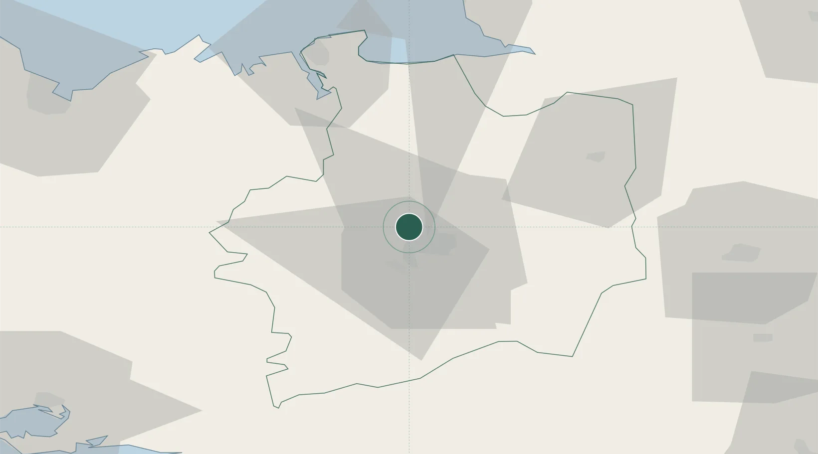
Nearby Logistics Neighbours

Cities
  1. 1La Chapelle-des-Fougeretz4 km
  2. 2Rennes6 km
  3. 3Betton7 km
  4. 4Chantepie11 km
  5. 5Noyal-Châtillon-sur-Seiche12 km
Nearest neighbours — logibook spatial index (haversine) over the source coordinates
Ports
  1. 1Saint-Malo60 km
  2. 2Granville77 km
  3. 3Le Legue88 km
  4. 4Donges98 km
  5. 5Montoir100 km
Nearest neighbours — logibook spatial index (haversine) over the source coordinates
Airports
  1. 1Rennes-Saint-Jacques Airport9 km
  2. 2Dinard Pleurtuit Saint-Malo airport56 km
  3. 3Laval-Entrammes Airport73 km
  4. 4Granville Airport82 km
  5. 5Vannes-Meucon Airport88 km
Nearest neighbours — logibook spatial index (haversine) over the source coordinates
Trade Zones
  1. 1ZFU Nantes et Saint-Herblain103 km
  2. 2ZFU Saint-Nazaire106 km
  3. 3ZFU Angers112 km
  4. 4ZFU Alençon137 km
  5. 5ZFU Le Mans138 km
Nearest neighbours — logibook spatial index (haversine) over the source coordinates
DatabookThe Record of Consolidated Knowledge
France beyond logistics?
Browse databook

All Sources

LocationsUN/LOCODE
UN/LOCODE — free
LocationsGeoNames
CC BY 4.0
Portsthe NGA World Port Index
Public domain (US gov)
AirportsOurAirports
Public domain
Trade Zonesthe World Bank SEZ database
CC BY 4.0
Trade ZonesOpen Zone Map
CC BY
← France locations