UN/LOCODE hub · France
FRCXY

Cordemais

47.2833°, -1.8833°
2,747
Population
1
Transport functions

Transport Functions

Port
UN/LOCODE

Hub Profile

Place type
Populated place
GeoNames
Region
Pays de la Loire
GeoNames
Population
2,747
GeoNames
Time zone
Europe/Paris
GeoNames
Elevation
17 m
GeoNames

Location

Location of FRCXY
Natural Earth 10m (public domain) · Pays de la Loire · FRCXY · 47.28, -1.88GoogleOSMYandex

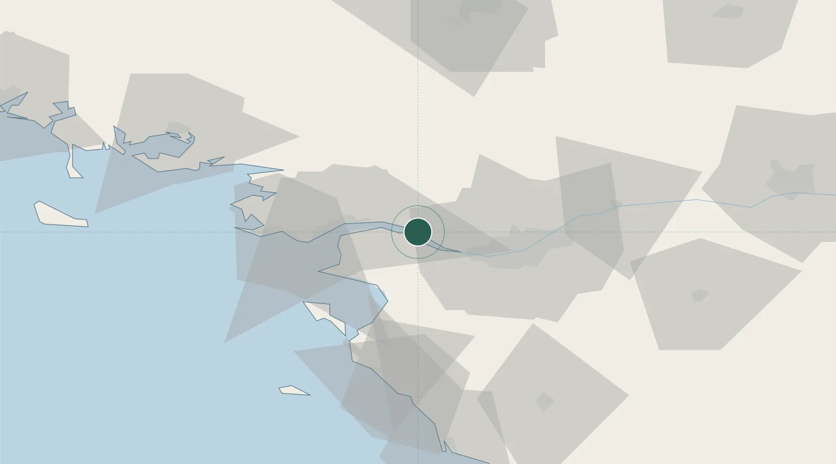
Nearby Logistics Neighbours

Cities
  1. 1Frossay5 km
  2. 2Nantes8 km
  3. 3Paimbuf10 km
  4. 4La Chapelle-Launay11 km
  5. 5Prinquiau14 km
Nearest neighbours — logibook spatial index (haversine) over the source coordinates
Ports
  1. 1Donges14 km
  2. 2Montoir19 km
  3. 3St Nazaire24 km
  4. 4Nantes26 km
  5. 5Les Sables D' Olonne87 km
Nearest neighbours — logibook spatial index (haversine) over the source coordinates
Airports
  1. 1Saint-Nazaire-Montoir Airport21 km
  2. 2Nantes Atlantique Airport25 km
  3. 3La Baule-Escoublac Airport35 km
  4. 4Beauvoir Fromentine Airfield46 km
  5. 5Ile D'Yeu Port Joinville Heliport71 km
Nearest neighbours — logibook spatial index (haversine) over the source coordinates
Trade Zones
  1. 1ZFU Nantes et Saint-Herblain15 km
  2. 2ZFU Saint-Nazaire30 km
  3. 3ZFU Angers99 km
  4. 4ZFU La Rochelle135 km
  5. 5ZFU Le Mans169 km
Nearest neighbours — logibook spatial index (haversine) over the source coordinates
DatabookThe Record of Consolidated Knowledge
France beyond logistics?
Browse databook

All Sources

LocationsUN/LOCODE
UN/LOCODE — free
LocationsGeoNames
CC BY 4.0
Portsthe NGA World Port Index
Public domain (US gov)
AirportsOurAirports
Public domain
Trade Zonesthe World Bank SEZ database
CC BY 4.0
Trade ZonesOpen Zone Map
CC BY
← France locations