UN/LOCODE hub · France
FRBMR

Batz-sur-Mer

47.2833°, -2.4833°
3,243
Population
2
Transport functions

Transport Functions

Rail
Road
UN/LOCODE

Hub Profile

Place type
Populated place
GeoNames
Region
Pays de la Loire
GeoNames
Population
3,243
GeoNames
Time zone
Europe/Paris
GeoNames
Elevation
18 m
GeoNames

Location

Location of FRBMR
Natural Earth 10m (public domain) · Pays de la Loire · FRBMR · 47.28, -2.48GoogleOSMYandex

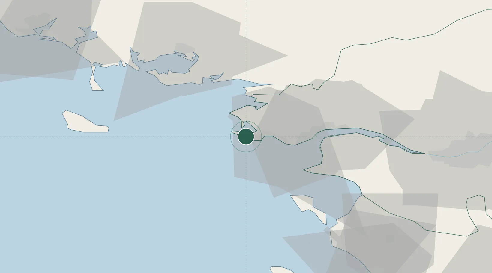
Nearby Logistics Neighbours

Cities
  1. 1Le Quesne1 km
  2. 2La Baule-Escoublac6 km
  3. 3Guérande8 km
  4. 4La Turballe8 km
  5. 5Pornichet11 km
Nearest neighbours — logibook spatial index (haversine) over the source coordinates
Ports
  1. 1St Nazaire21 km
  2. 2Montoir27 km
  3. 3Donges32 km
  4. 4Nantes70 km
  5. 5Lorient83 km
Nearest neighbours — logibook spatial index (haversine) over the source coordinates
Airports
  1. 1La Baule-Escoublac Airport10 km
  2. 2Saint-Nazaire-Montoir Airport25 km
  3. 3Vannes-Meucon Airport52 km
  4. 4Beauvoir Fromentine Airfield53 km
  5. 5Aérodrome de Belle Île54 km
Nearest neighbours — logibook spatial index (haversine) over the source coordinates
Trade Zones
  1. 1ZFU Saint-Nazaire16 km
  2. 2ZFU Nantes et Saint-Herblain59 km
  3. 3ZFU Angers144 km
  4. 4ZFU La Rochelle158 km
  5. 5ZFU Le Mans210 km
Nearest neighbours — logibook spatial index (haversine) over the source coordinates
DatabookThe Record of Consolidated Knowledge
France beyond logistics?
Browse databook

All Sources

LocationsUN/LOCODE
UN/LOCODE — free
LocationsGeoNames
CC BY 4.0
Portsthe NGA World Port Index
Public domain (US gov)
AirportsOurAirports
Public domain
Trade Zonesthe World Bank SEZ database
CC BY 4.0
Trade ZonesOpen Zone Map
CC BY
← France locations