UN/LOCODE hub · Finland
FIRTR

Rautaruukki

64.6500°, 24.4167°
1
Transport functions

Transport Functions

Port
UN/LOCODE

Hub Profile

Region
14
GeoNames

Location

Location of FIRTR
Natural Earth 10m (public domain) · 14 · FIRTR · 64.65, 24.42GoogleOSMYandex

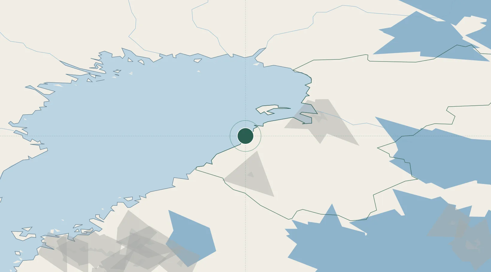
Nearby Logistics Neighbours

Cities
  1. 1Brahestad (Raahe)2 km
  2. 2Lapaluoto2 km
  3. 3Parhalahti19 km
  4. 4Ruukki32 km
  5. 5Hailuoto44 km
Nearest neighbours — logibook spatial index (haversine) over the source coordinates
Ports
  1. 1Raahe4 km
  2. 2Rahja60 km
  3. 3Oulu62 km
  4. 4Himanka81 km
  5. 5Kokkola112 km
Nearest neighbours — logibook spatial index (haversine) over the source coordinates
Airports
  1. 1Oulu Airport54 km
  2. 2Ylivieska Airfield68 km
  3. 3Kokkola-Pietarsaari Airport120 km
  4. 4Kemi-Tornio Airport126 km
  5. 5Luleå Airport146 km
Nearest neighbours — logibook spatial index (haversine) over the source coordinates
Trade Zones
  1. 1Oulu Port Free Warehouse Area61 km
  2. 2Free Zone of Lappeenranta443 km
  3. 3Turku Free Zone481 km
  4. 4Port of Hamina-Kotka482 km
  5. 5Freeport of Hanko542 km
Nearest neighbours — logibook spatial index (haversine) over the source coordinates
DatabookThe Record of Consolidated Knowledge
Finland beyond logistics?
Browse databook

All Sources

LocationsUN/LOCODE
UN/LOCODE — free
Portsthe NGA World Port Index
Public domain (US gov)
AirportsOurAirports
Public domain
Trade Zonesthe World Bank SEZ database
CC BY 4.0
Trade ZonesOpen Zone Map
CC BY
← Finland locations