UN/LOCODE hub · Spain
ESPES

Peñalsordo

38.8167°, -5.1167°
1,379
Population
1
Transport functions

Transport Functions

Multimodal
UN/LOCODE

Hub Profile

Place type
District seat
GeoNames
Region
Extremadura
GeoNames
Population
1,379
GeoNames
Time zone
Europe/Madrid
GeoNames
Elevation
423 m
GeoNames

Location

Location of ESPES
Natural Earth 10m (public domain) · Extremadura · ESPES · 38.82, -5.12GoogleOSMYandex

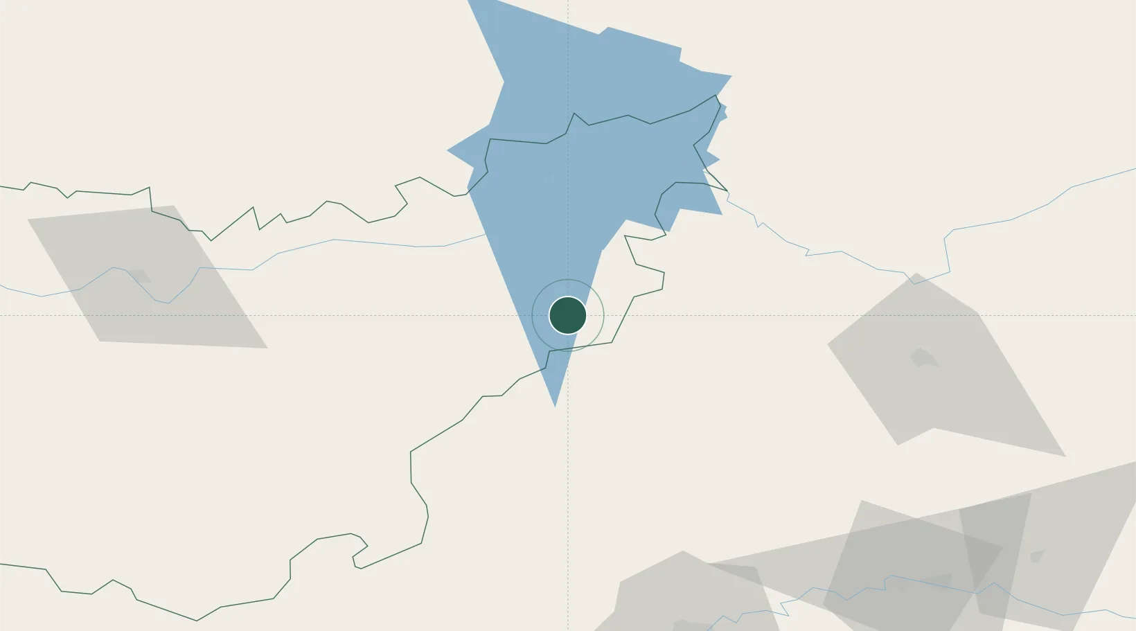
Nearby Logistics Neighbours

Cities
  1. 1Zarza Capilla3 km
  2. 2La Puebla de Alcocer22 km
  3. 3Talarrubias26 km
  4. 4Hinojosa del Duque35 km
  5. 5Casas de Don Pedro36 km
Nearest neighbours — logibook spatial index (haversine) over the source coordinates
Ports
  1. 1Sevilla179 km
  2. 2Huelva237 km
  3. 3Malaga242 km
  4. 4Rota267 km
  5. 5Motril269 km
Nearest neighbours — logibook spatial index (haversine) over the source coordinates
Airports
  1. 1Ciudad Real International Airport99 km
  2. 2Córdoba Airport111 km
  3. 3Badajoz Airport148 km
  4. 4Seville Airport170 km
  5. 5Madroñalejos Forest Fire fighting Heliport176 km
Nearest neighbours — logibook spatial index (haversine) over the source coordinates
Trade Zones
  1. 1Zona Franca de Sevilla182 km
  2. 2Depósito Franco de Málaga204 km
  3. 3Depósito Franco de Madrid-Aeropuerto225 km
  4. 4Puerto de Huelva237 km
  5. 5Zona Franca de Cádiz277 km
Nearest neighbours — logibook spatial index (haversine) over the source coordinates
DatabookThe Record of Consolidated Knowledge
Spain beyond logistics?
Browse databook

All Sources

LocationsUN/LOCODE
UN/LOCODE — free
LocationsGeoNames
CC BY 4.0
Portsthe NGA World Port Index
Public domain (US gov)
AirportsOurAirports
Public domain
Trade Zonesthe World Bank SEZ database
CC BY 4.0
Trade ZonesOpen Zone Map
CC BY
← Spain locations