UN/LOCODE hub · Ecuador
ECESP

Espanola Island

-1.3833°, -89.6833°
1
Transport functions

Transport Functions

Port
UN/LOCODE

Hub Profile

Region
W
GeoNames

Location

Location of ECESP
Natural Earth 10m (public domain) · W · ECESP · -1.38, -89.68GoogleOSMYandex

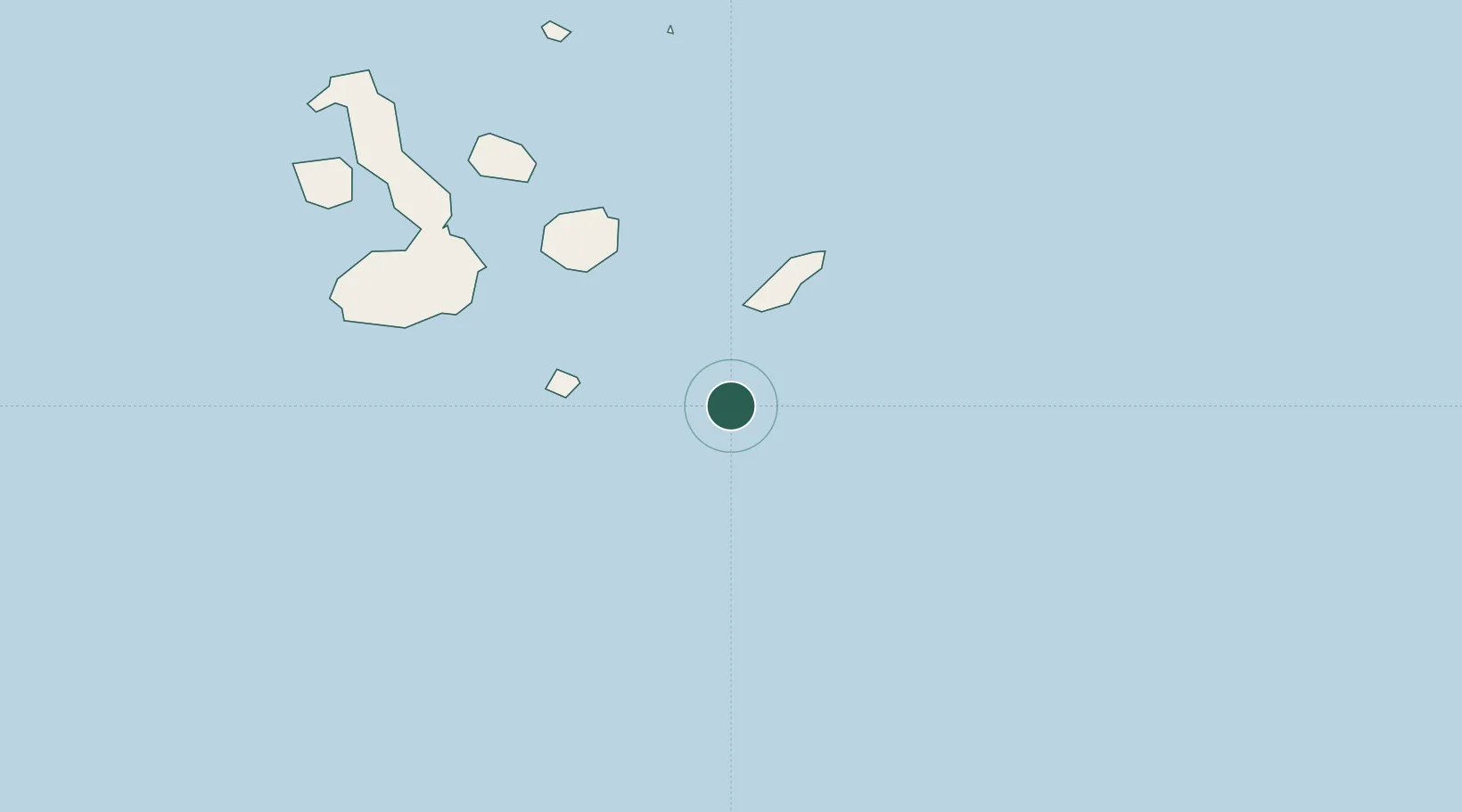
Nearby Logistics Neighbours

Cities
  1. 1Puerto Baquerizo Moreno55 km
  2. 2Floreana Island84 km
  3. 3Puerto Ayora, Isla Santa Cruz100 km
  4. 4Seymour127 km
  5. 5Bartolome Island156 km
Nearest neighbours — logibook spatial index (haversine) over the source coordinates
Ports
  1. 1La Libertad979 km
  2. 2Puerto Cabo Blanco991 km
  3. 3Caleta Lobitos993 km
  4. 4Manta998 km
  5. 5Talara998 km
Nearest neighbours — logibook spatial index (haversine) over the source coordinates
Airports
  1. 1San Cristóbal Airport53 km
  2. 2Seymour Galapagos Ecological Airport122 km
  3. 3General Villamil Airport149 km
  4. 4General Ulpiano Paez International Airport971 km
  5. 5Captain Victor Montes Arias International Airport1001 km
Nearest neighbours — logibook spatial index (haversine) over the source coordinates
Trade Zones
  1. 1Zona Franca de Manta996 km
  2. 2Zona Franca Manabí1001 km
  3. 3Zona Especial de Desarrollo Paita (Special Development Zone of Paita)1040 km
  4. 4DP World Posorja1058 km
  5. 5Posorja ZofraPort SA Free Zone1058 km
Nearest neighbours — logibook spatial index (haversine) over the source coordinates
DatabookThe Record of Consolidated Knowledge
Ecuador beyond logistics?
Browse databook

All Sources

LocationsUN/LOCODE
UN/LOCODE — free
Portsthe NGA World Port Index
Public domain (US gov)
AirportsOurAirports
Public domain
Trade Zonesthe World Bank SEZ database
CC BY 4.0
Trade ZonesOpen Zone Map
CC BY
← Ecuador locations