UN/LOCODE hub · Germany
DEVRW

Viewrow

54.1167°, 13.5833°
1
Transport functions

Transport Functions

Port
UN/LOCODE

Hub Profile

Region
MV
GeoNames

Location

Location of DEVRW
Natural Earth 10m (public domain) · MV · DEVRW · 54.12, 13.58GoogleOSMYandex

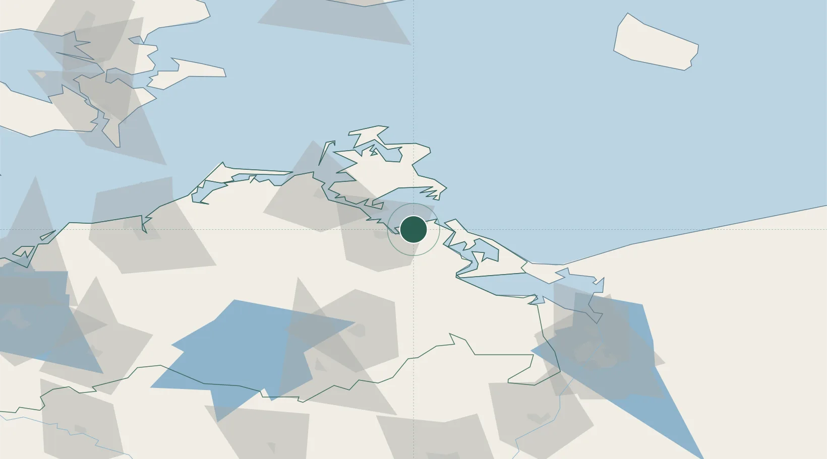
Nearby Logistics Neighbours

Cities
  1. 1Lubmin2 km
  2. 2Peenemünde13 km
  3. 3Zinnowitz21 km
  4. 4Gager21 km
  5. 5Stahlbrode23 km
Nearest neighbours — logibook spatial index (haversine) over the source coordinates
Ports
  1. 1Wolgast15 km
  2. 2Stralsund39 km
  3. 3Sassnitz45 km
  4. 4Swinoujscie50 km
  5. 5Police89 km
Nearest neighbours — logibook spatial index (haversine) over the source coordinates
Airports
  1. 1Heringsdorf Airport46 km
  2. 2Neubrandenburg Trollenhagen Airport60 km
  3. 3Rostock-Laage Airport88 km
  4. 4Solidarity Szczecin–Goleniów Airport105 km
  5. 5Bornholm Airport130 km
Nearest neighbours — logibook spatial index (haversine) over the source coordinates
Trade Zones
  1. 1Swinoujscie Duty Free Zone51 km
  2. 2Szczecin Duty Free Zone101 km
  3. 3MTS Malmö Transport and Spedition169 km
  4. 4Kostrzyń-Słubice SEZ183 km
  5. 5Freeport of Copenhagen- Nordhavn189 km
Nearest neighbours — logibook spatial index (haversine) over the source coordinates
DatabookThe Record of Consolidated Knowledge
Germany beyond logistics?
Browse databook

All Sources

LocationsUN/LOCODE
UN/LOCODE — free
Portsthe NGA World Port Index
Public domain (US gov)
AirportsOurAirports
Public domain
Trade Zonesthe World Bank SEZ database
CC BY 4.0
Trade ZonesOpen Zone Map
CC BY
← Germany locations