UN/LOCODE hub · Germany
DEPEF

Peenemünde

54.1333°, 13.7833°
3
Transport functions

Transport Functions

Port
Road
Airport
UN/LOCODE

Hub Profile

Region
MV
GeoNames

Location

Location of DEPEF
Natural Earth 10m (public domain) · MV · DEPEF · 54.13, 13.78GoogleOSMYandex

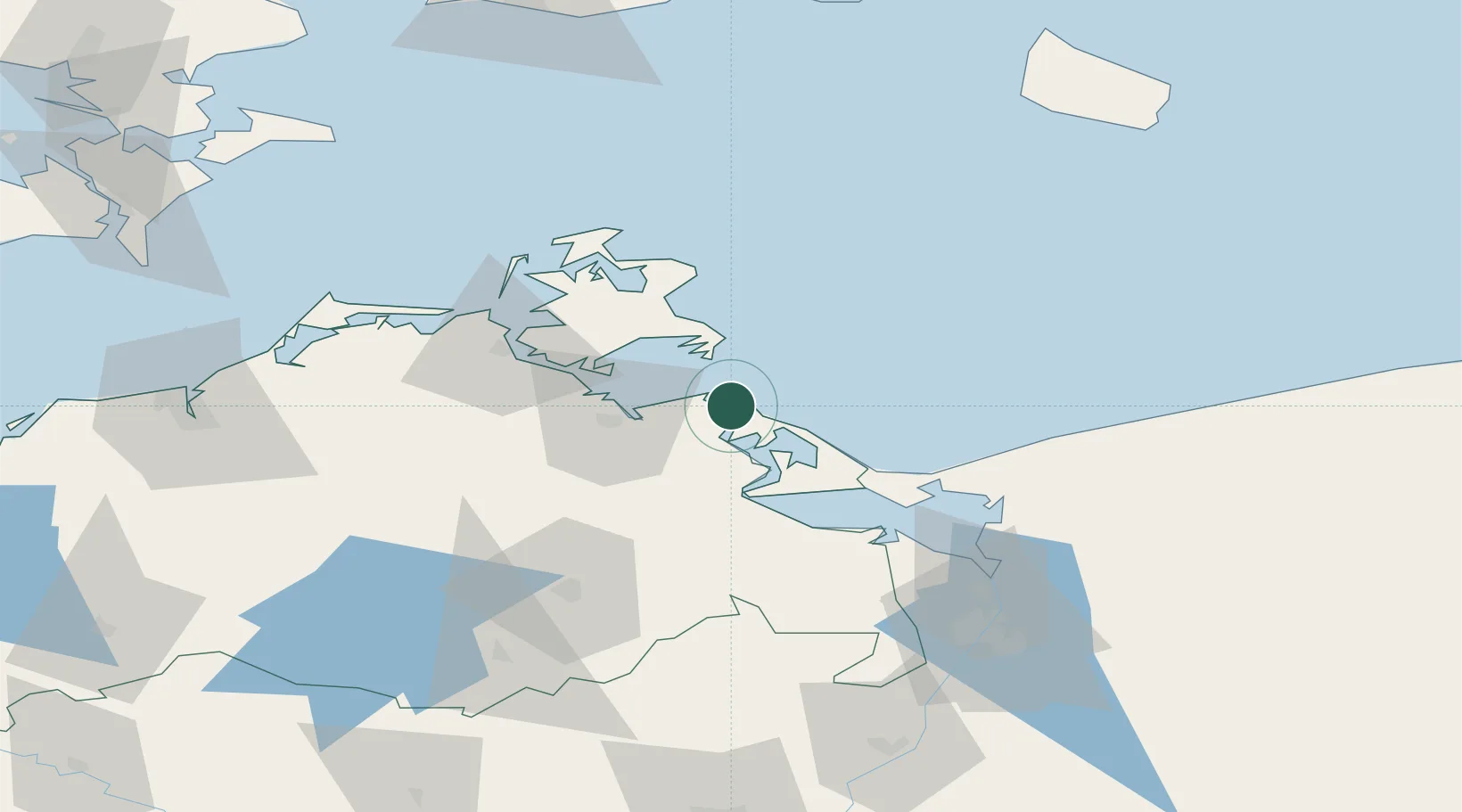
Nearby Logistics Neighbours

Cities
  1. 1Zinnowitz11 km
  2. 2Lubmin12 km
  3. 3Viewrow13 km
  4. 4Vierow19 km
  5. 5Gager20 km
Nearest neighbours — logibook spatial index (haversine) over the source coordinates
Ports
  1. 1Wolgast9 km
  2. 2Swinoujscie40 km
  3. 3Sassnitz44 km
  4. 4Stralsund49 km
  5. 5Police81 km
Nearest neighbours — logibook spatial index (haversine) over the source coordinates
Airports
  1. 1Heringsdorf Airport37 km
  2. 2Neubrandenburg Trollenhagen Airport67 km
  3. 3Solidarity Szczecin–Goleniów Airport95 km
  4. 4Rostock-Laage Airport101 km
  5. 5Bornholm Airport121 km
Nearest neighbours — logibook spatial index (haversine) over the source coordinates
Trade Zones
  1. 1Swinoujscie Duty Free Zone42 km
  2. 2Szczecin Duty Free Zone95 km
  3. 3MTS Malmö Transport and Spedition170 km
  4. 4Kostrzyń-Słubice SEZ180 km
  5. 5Freeport of Copenhagen- Nordhavn191 km
Nearest neighbours — logibook spatial index (haversine) over the source coordinates
DatabookThe Record of Consolidated Knowledge
Germany beyond logistics?
Browse databook

All Sources

LocationsUN/LOCODE
UN/LOCODE — free
Portsthe NGA World Port Index
Public domain (US gov)
AirportsOurAirports
Public domain
Trade Zonesthe World Bank SEZ database
CC BY 4.0
Trade ZonesOpen Zone Map
CC BY
← Germany locations