UN/LOCODE hub · Germany
DESSQ

Schönborn

51.6000°, 13.5000°
1,881
Population
2
Transport functions

Transport Functions

Road
Multimodal
UN/LOCODE

Hub Profile

Place type
Local administrative seat
GeoNames
Region
Brandenburg
GeoNames
Population
1,881
GeoNames
Time zone
Europe/Berlin
GeoNames
Elevation
107 m
GeoNames

Location

Location of DESSQ
Natural Earth 10m (public domain) · Brandenburg · DESSQ · 51.60, 13.50GoogleOSMYandex

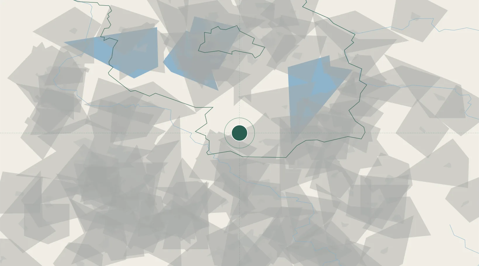
Nearby Logistics Neighbours

Cities
  1. 1Doberlug-Kirchhain5 km
  2. 2Bad Liebenwerda12 km
  3. 3Uebigau14 km
  4. 4Elsterwerda15 km
  5. 5Finsterwalde/Niederlausitz15 km
Nearest neighbours — logibook spatial index (haversine) over the source coordinates
Ports
  1. 1Szczecin214 km
  2. 2Police230 km
  3. 3Swinoujscie263 km
  4. 4Wolgast273 km
  5. 5Wismar290 km
Nearest neighbours — logibook spatial index (haversine) over the source coordinates
Airports
  1. 1Holzdorf Air Base30 km
  2. 2Dresden Airport55 km
  3. 3Berlin Brandenburg Airport85 km
  4. 4Leipzig/Halle Airport90 km
  5. 5Leipzig–Altenburg Airport98 km
Nearest neighbours — logibook spatial index (haversine) over the source coordinates
Trade Zones
  1. 1Most - Joseph Industrial Zone124 km
  2. 2Žatec - Triangle Strategic Industrial Zone134 km
  3. 3Kostrzyń-Słubice SEZ135 km
  4. 4Podbořany Industrial Zone153 km
  5. 5Legnica SEZ (Legnicka SSE)172 km
Nearest neighbours — logibook spatial index (haversine) over the source coordinates
DatabookThe Record of Consolidated Knowledge
Germany beyond logistics?
Browse databook

All Sources

LocationsUN/LOCODE
UN/LOCODE — free
LocationsGeoNames
CC BY 4.0
Portsthe NGA World Port Index
Public domain (US gov)
AirportsOurAirports
Public domain
Trade Zonesthe World Bank SEZ database
CC BY 4.0
Trade ZonesOpen Zone Map
CC BY
← Germany locations