UN/LOCODE hub · Germany
DEHOO

Hooksiel

53.6333°, 8.0167°
2
Transport functions

Transport Functions

Port
Road
UN/LOCODE

Hub Profile

Place type
Populated place
GeoNames
Region
Lower Saxony
GeoNames
Time zone
Europe/Berlin
GeoNames
Elevation
0 m
GeoNames

Location

Location of DEHOO
Natural Earth 10m (public domain) · Lower Saxony · DEHOO · 53.63, 8.02GoogleOSMYandex

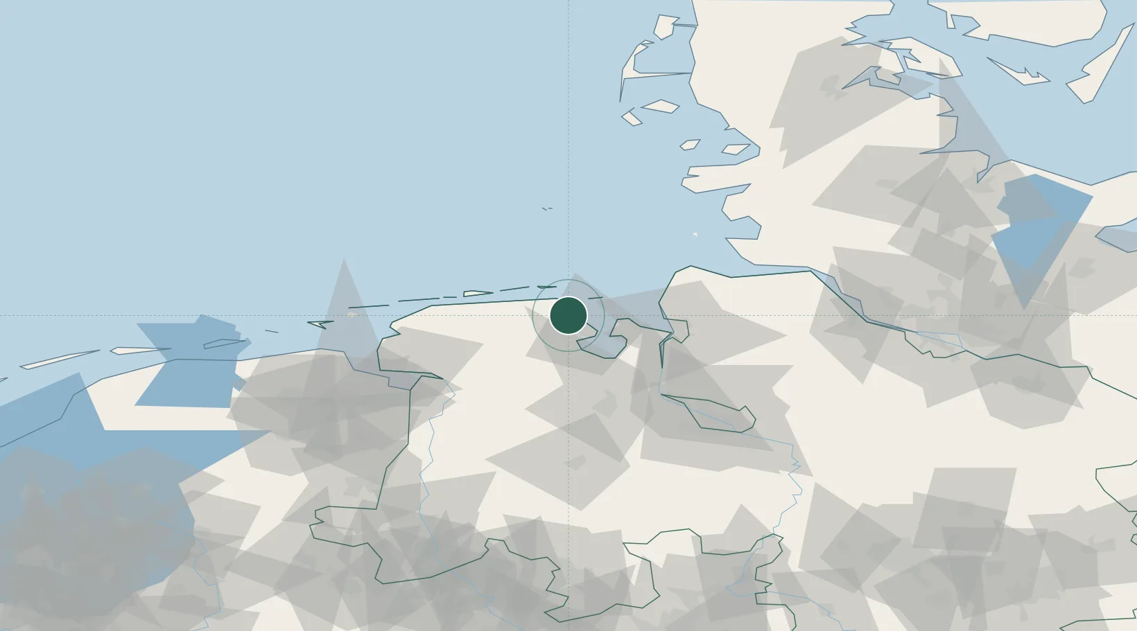
Nearby Logistics Neighbours

Cities
  1. 1Horumersiel6 km
  2. 2Minsen8 km
  3. 3Wilhelmshaven10 km
  4. 4Mariensiel15 km
  5. 5Carolinensiel16 km
Nearest neighbours — logibook spatial index (haversine) over the source coordinates
Ports
  1. 1Wilhelmshaven15 km
  2. 2Nordenham35 km
  3. 3Bremerhaven39 km
  4. 4Brake46 km
  5. 5Cuxhaven53 km
Nearest neighbours — logibook spatial index (haversine) over the source coordinates
Airports
  1. 1Harlesiel Airfield15 km
  2. 2Wangerooge Airport18 km
  3. 3Wittmundhafen Air Base25 km
  4. 4Baltrum Airport44 km
  5. 5Sea-Airport Cuxhaven/Nordholz / Nordholz Naval Airbase45 km
Nearest neighbours — logibook spatial index (haversine) over the source coordinates
Trade Zones
  1. 1Freeport of Cuxhaven (Freihafen Cuxhaven)42 km
  2. 2Freeport of Emden64 km
  3. 3Freeport of Bremerhaven (Freihafen Bremerhaven)78 km
  4. 4Freeport of Kiel161 km
  5. 5Freeport of Duisburg262 km
Nearest neighbours — logibook spatial index (haversine) over the source coordinates
DatabookThe Record of Consolidated Knowledge
Germany beyond logistics?
Browse databook

All Sources

LocationsUN/LOCODE
UN/LOCODE — free
Portsthe NGA World Port Index
Public domain (US gov)
AirportsOurAirports
Public domain
Trade Zonesthe World Bank SEZ database
CC BY 4.0
Trade ZonesOpen Zone Map
CC BY
← Germany locations