UN/LOCODE hub · China
CNYNC

Yongchun,Quanzhou

25.3000°, 118.2167°
3
Transport functions

Transport Functions

Rail
Road
Multimodal
UN/LOCODE

Hub Profile

Region
FJ
GeoNames

Location

Location of CNYNC
Natural Earth 10m (public domain) · FJ · CNYNC · 25.30, 118.22GoogleOSMYandex

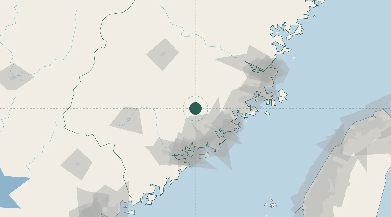
Nearby Logistics Neighbours

Cities
  1. 1Anxi,Quanzhou26 km
  2. 2Dehua30 km
  3. 3Quanzhou56 km
  4. 4Gaozhou57 km
  5. 5Jinjiang Dry Port62 km
Nearest neighbours — logibook spatial index (haversine) over the source coordinates
Ports
  1. 1Quanzhou60 km
  2. 2Zhangzhou69 km
  3. 3Xiuyu77 km
  4. 4Xiamen96 km
  5. 5Fuzhou139 km
Nearest neighbours — logibook spatial index (haversine) over the source coordinates
Airports
  1. 1Huian Air Base67 km
  2. 2Quanzhou Jinjiang International Airport67 km
  3. 3Xiamen Gaoqi International Airport85 km
  4. 4Kinmen Airport98 km
  5. 5Fuzhou Zhuqi Heliport128 km
Nearest neighbours — logibook spatial index (haversine) over the source coordinates
Trade Zones
  1. 1Yongchun Industrial Park9 km
  2. 2Dehua Ceramic Industrial Park23 km
  3. 3Anxi Economic Development Zone28 km
  4. 4Nanan Economic Development Zone39 km
  5. 5Quanzhou Export Processing Zone58 km
Nearest neighbours — logibook spatial index (haversine) over the source coordinates
DatabookThe Record of Consolidated Knowledge
China beyond logistics?
Browse databook

All Sources

LocationsUN/LOCODE
UN/LOCODE — free
Portsthe NGA World Port Index
Public domain (US gov)
AirportsOurAirports
Public domain
Trade Zonesthe World Bank SEZ database
CC BY 4.0
Trade ZonesOpen Zone Map
CC BY
← China locations