UN/LOCODE hub · China
CNXYG

Xiuyu Pt

25.2333°, 118.9500°
1
Transport functions

Transport Functions

Port
Xiuyu Pt is also a profiled seaport →
UN/LOCODE

Hub Profile

Region
FJ
GeoNames

Location

Location of CNXYG
Natural Earth 10m (public domain) · FJ · CNXYG · 25.23, 118.95GoogleOSMYandex

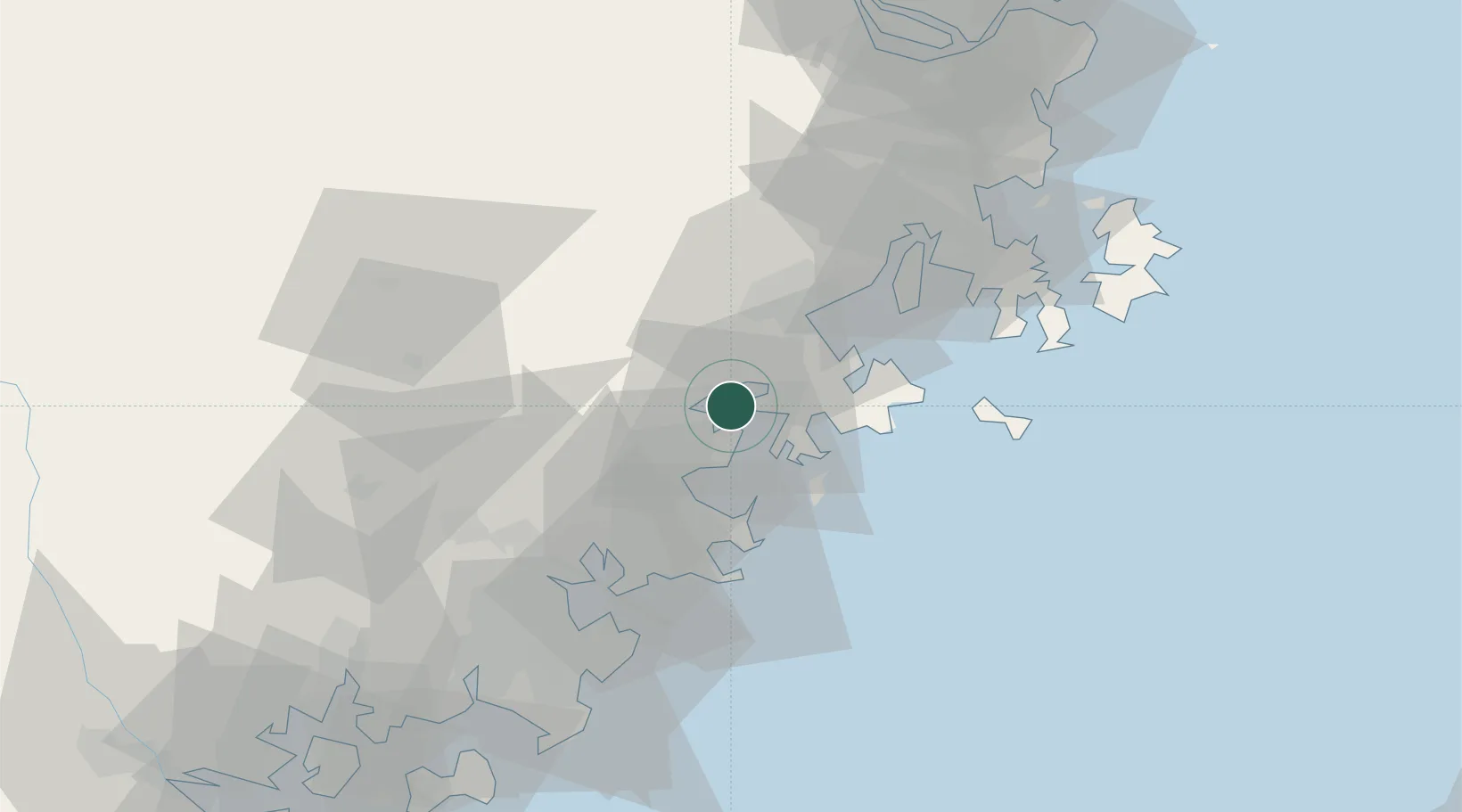
Nearby Logistics Neighbours

Cities
  1. 1Quangang,Quanzhou12 km
  2. 2Hui'an,Quanzhou22 km
  3. 3Jiangyin44 km
  4. 4Houzhu48 km
  5. 5Quanzhou49 km
Nearest neighbours — logibook spatial index (haversine) over the source coordinates
Ports
  1. 1Quanzhou53 km
  2. 2Fuzhou101 km
  3. 3Zhangzhou101 km
  4. 4Xiamen125 km
  5. 5Tai-Chung Kang188 km
Nearest neighbours — logibook spatial index (haversine) over the source coordinates
Airports
  1. 1Huian Air Base27 km
  2. 2Quanzhou Jinjiang International Airport61 km
  3. 3Longtian Air Base64 km
  4. 4Fuzhou Air Base93 km
  5. 5Fuzhou Zhuqi Heliport100 km
Nearest neighbours — logibook spatial index (haversine) over the source coordinates
Trade Zones
  1. 1Meizhou Bay North Shore Economic Development Zone15 km
  2. 2Hualin Economic Development Zone18 km
  3. 3Huian Economic Development Zone28 km
  4. 4Huidong Industrial Park28 km
  5. 5Licheng Economic Development Zone31 km
Nearest neighbours — logibook spatial index (haversine) over the source coordinates
DatabookThe Record of Consolidated Knowledge
China beyond logistics?
Browse databook

All Sources

LocationsUN/LOCODE
UN/LOCODE — free
Portsthe NGA World Port Index
Public domain (US gov)
AirportsOurAirports
Public domain
Trade Zonesthe World Bank SEZ database
CC BY 4.0
Trade ZonesOpen Zone Map
CC BY
← China locations