UN/LOCODE hub · China
CNDAW

Dawa

40.9833°, 122.0667°
1
Transport functions

Transport Functions

Multimodal
UN/LOCODE

Hub Profile

Place type
District seat
GeoNames
Region
Liaoning
GeoNames
Time zone
Asia/Shanghai
GeoNames
Elevation
5 m
GeoNames

Location

Location of CNDAW
Natural Earth 10m (public domain) · Liaoning · CNDAW · 40.98, 122.07GoogleOSMYandex

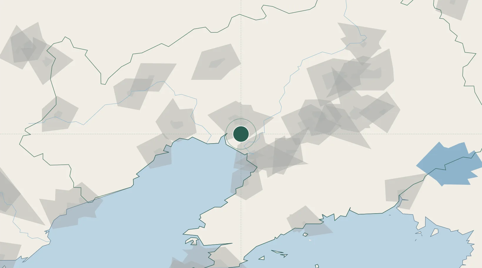
Nearby Logistics Neighbours

Cities
  1. 1Panjin33 km
  2. 2Goubangzi48 km
  3. 3Beizhen58 km
  4. 4Heishan78 km
  5. 5Yinkou79 km
Nearest neighbours — logibook spatial index (haversine) over the source coordinates
Ports
  1. 1Yingkou36 km
  2. 2Bayuquan76 km
  3. 3Jinzhou Wan85 km
  4. 4Huludao Gang96 km
  5. 5Dandong219 km
Nearest neighbours — logibook spatial index (haversine) over the source coordinates
Airports
  1. 1Yingkou Lanqi Airport55 km
  2. 2Jinzhou Bay Airport67 km
  3. 3Anshan Teng'ao Airport / Anshan Air Base67 km
  4. 4Xingcheng Air Base124 km
  5. 5Fuxin Air Base126 km
Nearest neighbours — logibook spatial index (haversine) over the source coordinates
Trade Zones
  1. 1Dawa Lingang Economic Zone17 km
  2. 2Panjin High-tech Industrial Development Zone20 km
  3. 3Liaoning North New Material Industrial Park30 km
  4. 4Yingkou Coastal Industrial Base42 km
  5. 5Goubangzi Economic Development Zone50 km
Nearest neighbours — logibook spatial index (haversine) over the source coordinates
DatabookThe Record of Consolidated Knowledge
China beyond logistics?
Browse databook

All Sources

LocationsUN/LOCODE
UN/LOCODE — free
Portsthe NGA World Port Index
Public domain (US gov)
AirportsOurAirports
Public domain
Trade Zonesthe World Bank SEZ database
CC BY 4.0
Trade ZonesOpen Zone Map
CC BY
← China locations