UN/LOCODE hub · Canada
CAZTI

Saint-Tite

46.7333°, -72.5667°
3,880
Population
4
Transport functions

Transport Functions

Port
Rail
Road
Multimodal
UN/LOCODE

Hub Profile

Place type
Populated place
GeoNames
Region
Quebec
GeoNames
Population
3,880
GeoNames
Time zone
America/Toronto
GeoNames
Elevation
134 m
GeoNames

Location

Location of CAZTI
Natural Earth 10m (public domain) · Quebec · CAZTI · 46.73, -72.57GoogleOSMYandex

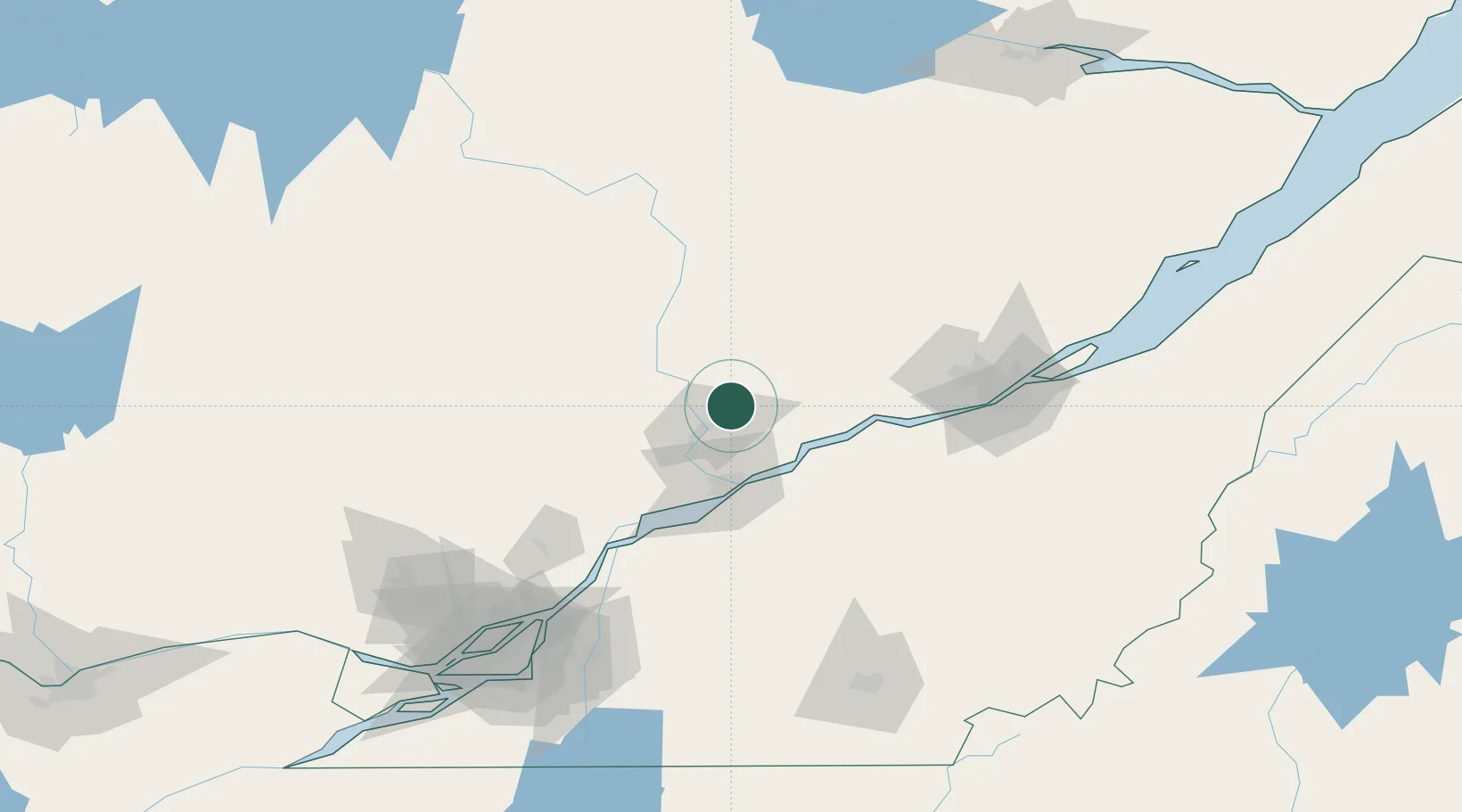
Nearby Logistics Neighbours

Cities
  1. 1Saint-Georges15 km
  2. 2Grand Mere16 km
  3. 3Rivière-Matawin32 km
  4. 4Saint-Mathieu-du-Parc33 km
  5. 5Sainte-Anne-de-la-Perade33 km
Nearest neighbours — logibook spatial index (haversine) over the source coordinates
Ports
  1. 1Port De Becancour40 km
  2. 2Trois Rivieres43 km
  3. 3Sorel87 km
  4. 4Quebec103 km
  5. 5Contrecour106 km
Nearest neighbours — logibook spatial index (haversine) over the source coordinates
Airports
  1. 1Trois-Rivières Airport43 km
  2. 2Quebec Jean Lesage International Airport90 km
  3. 3Montréal / Saint-Hubert Metropolitan Airport150 km
  4. 4Saint-Georges Airport159 km
  5. 5Sherbrooke Airport159 km
Nearest neighbours — logibook spatial index (haversine) over the source coordinates
Trade Zones
  1. 1Québec City FTZ101 km
  2. 2Greater Montreal Free Zone Center156 km
  3. 3FTZ No. 118 Ogdensburg321 km
  4. 4FTZ No. 179 Madawaska326 km
  5. 5FTZ No. 186 Waterville330 km
Nearest neighbours — logibook spatial index (haversine) over the source coordinates
DatabookThe Record of Consolidated Knowledge
Canada beyond logistics?
Browse databook

All Sources

LocationsUN/LOCODE
UN/LOCODE — free
LocationsGeoNames
CC BY 4.0
Portsthe NGA World Port Index
Public domain (US gov)
AirportsOurAirports
Public domain
Trade Zonesthe World Bank SEZ database
CC BY 4.0
Trade ZonesOpen Zone Map
CC BY
← Canada locations