Channel & Berth Profile
Pilotage, Tugs & Services
Pilotage compulsoryYES
Pilotage advisableYES
Local assistanceYES
Tug assistanceYES
Shore powerYES
Potable waterYES
Diesel bunkersYES
MedicalYES
Facilities & Capabilities
Container—
Ro-Ro—
Liquid bulk—
Dry bulk—
Oil terminal—
Break bulk—
Dry dockNO
RepairsNO
BunkeringYES
Rail linkYES
Dangerous cargo—
ISPS security—
Harbour Specifications
Harbour size
Medium
Harbour type
River (Natural)
Shelter
Good
Water body
Gulf of Saint Lawrence; North Atlantic Ocean
Tidal range
8 m
Overhead limit
No
Pilotage
Yes
Liner Connectivity
12.9
PLSCI
Port Liner Shipping Connectivity Index for Quebec, as published by UNCTAD for the latest available quarter. Higher values indicate stronger scheduled liner-shipping integration.
Shown relative to the highest per-port PLSCI in the dataset (1,657.9).
Location
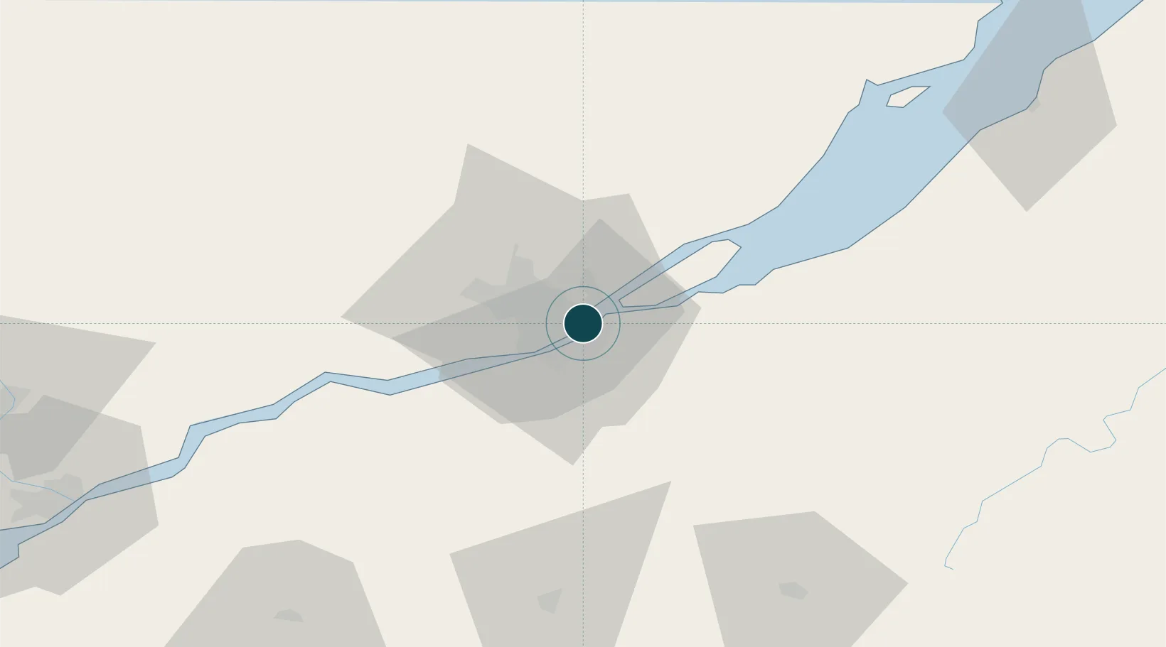
Nearby Logistics Neighbours
Ports
- 1Port De Becancour100 km
- 2Trois Rivieres114 km
- 3Sorel169 km
- 4La Baie (Port Alfred)171 km
- 5Riviere Du Loup171 km
Cities
- 1Saint-Frédéric3 km
- 2Vanier4 km
- 3Lévis4 km
- 4Saint-Romuald-d'Etchemin8 km
- 5Saint-Jean-Chrysostome11 km
Airports
- 1Quebec Jean Lesage International Airport14 km
- 2Saint-Georges Airport89 km
- 3Charlevoix Airport115 km
- 4Trois-Rivières Airport123 km
- 5Sherbrooke Airport158 km
Trade Zones
- 1Québec City FTZ3 km
- 2FTZ No. 179 Madawaska224 km
- 3Greater Montreal Free Zone Center232 km
- 4FTZ No. 186 Waterville279 km
- 5FTZ No. 058 Bangor291 km
DatabookThe Record of Consolidated Knowledge
Canada beyond logistics?