UN/LOCODE hub · Canada
CAVOS

Prévost

45.8667°, -74.0833°
10,132
Population
2
Transport functions

Transport Functions

Port
Multimodal
UN/LOCODE

Hub Profile

Place type
Populated place
GeoNames
Region
Quebec
GeoNames
Population
10,132
GeoNames
Time zone
America/Toronto
GeoNames
Elevation
166 m
GeoNames

Location

Location of CAVOS
Natural Earth 10m (public domain) · Quebec · CAVOS · 45.87, -74.08GoogleOSMYandex

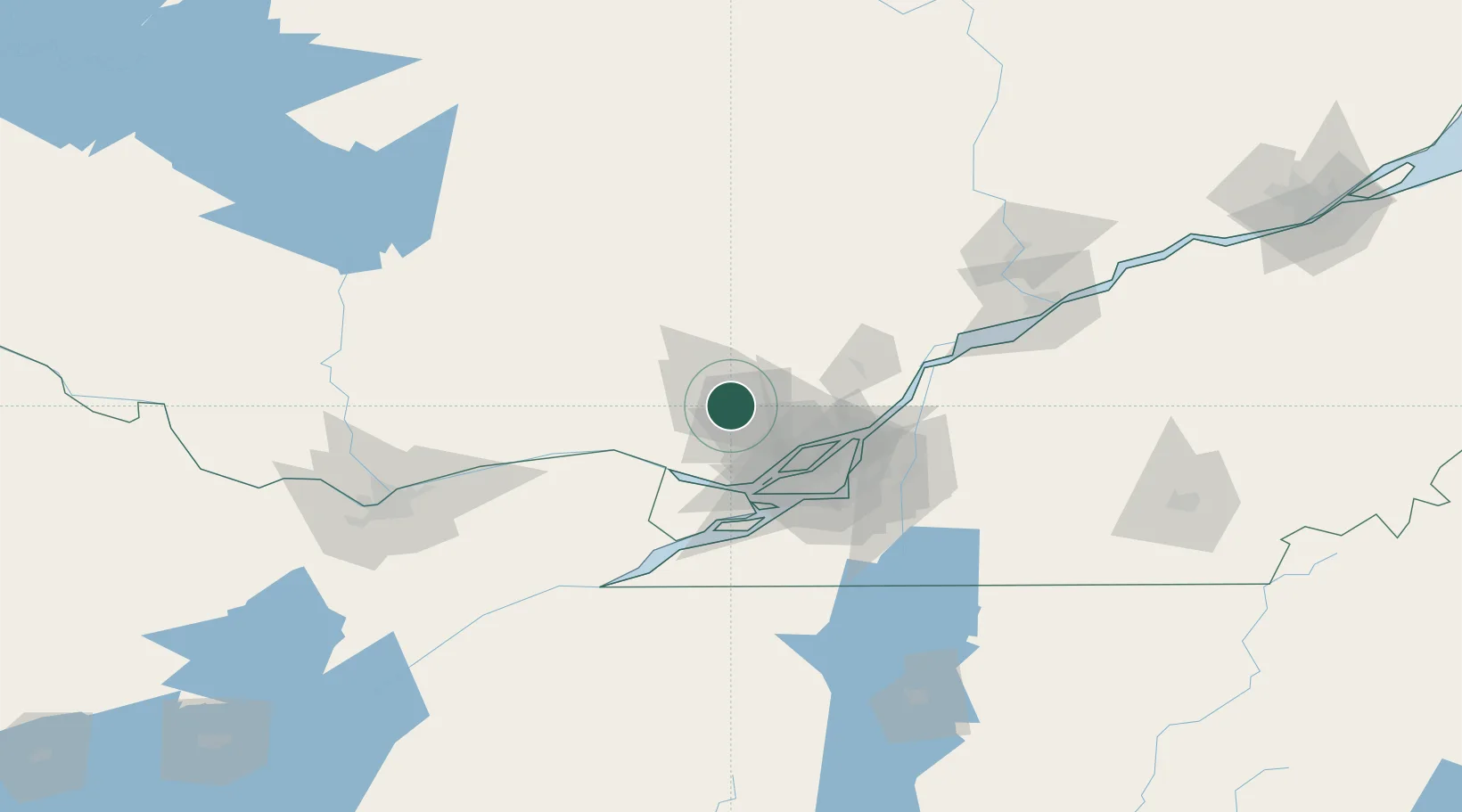
Nearby Logistics Neighbours

Cities
  1. 1Saint-Antoine-des-Laurentides16 km
  2. 2Saint-Janvier23 km
  3. 3Sainte-Anne-des-Plaines24 km
  4. 4Sainte-Thérèse32 km
  5. 5Saint-Eustache36 km
Nearest neighbours — logibook spatial index (haversine) over the source coordinates
Ports
  1. 1St Placide38 km
  2. 2St Andrews East39 km
  3. 3Chute A Blondeau43 km
  4. 4Oka Sur Le Lac45 km
  5. 5Hudson45 km
Nearest neighbours — logibook spatial index (haversine) over the source coordinates
Trade Zones
  1. 1Greater Montreal Free Zone Center57 km
  2. 2FTZ No. 118 Ogdensburg170 km
  3. 3Québec City FTZ242 km
  4. 4FTZ No. 109 Watertown253 km
  5. 5FTZ No. 172 Oneida County331 km
Nearest neighbours — logibook spatial index (haversine) over the source coordinates
DatabookThe Record of Consolidated Knowledge
Canada beyond logistics?
Browse databook

All Sources

LocationsUN/LOCODE
UN/LOCODE — free
LocationsGeoNames
CC BY 4.0
Portsthe NGA World Port Index
Public domain (US gov)
AirportsOurAirports
Public domain
Trade Zonesthe World Bank SEZ database
CC BY 4.0
Trade ZonesOpen Zone Map
CC BY
← Canada locations