UN/LOCODE hub · Canada
CASMG

Shemogue

46.1500°, -64.1833°
1
Transport functions

Transport Functions

Multimodal
UN/LOCODE

Hub Profile

Place type
Populated place
GeoNames
Region
New Brunswick
GeoNames
Time zone
America/Moncton
GeoNames
Elevation
21 m
GeoNames

Location

Location of CASMG
Natural Earth 10m (public domain) · New Brunswick · CASMG · 46.15, -64.18GoogleOSMYandex

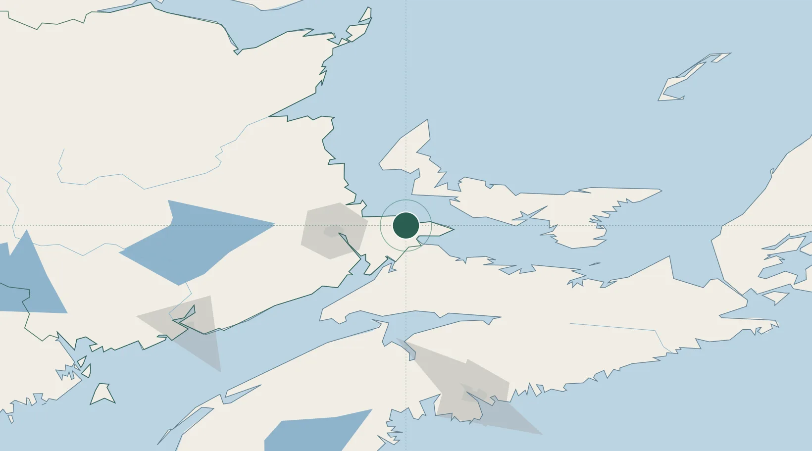
Nearby Logistics Neighbours

Cities
  1. 1Little Shemogue13 km
  2. 2Port Elgin15 km
  3. 3O'Leary28 km
  4. 4Grande-Digue32 km
  5. 5Amherst37 km
Nearest neighbours — logibook spatial index (haversine) over the source coordinates
Ports
  1. 1Summerside41 km
  2. 2Charlottetown81 km
  3. 3Pictou126 km
  4. 4Georgetown127 km
  5. 5Windsor128 km
Nearest neighbours — logibook spatial index (haversine) over the source coordinates
Airports
  1. 1Greater Moncton Roméo LeBlanc International Airport38 km
  2. 2Summerside Airport42 km
  3. 3Fox Harbour Airport64 km
  4. 4Charlottetown Airport83 km
  5. 5Miramichi Airport136 km
Nearest neighbours — logibook spatial index (haversine) over the source coordinates
Trade Zones
  1. 1Halifax Gateway173 km
  2. 2Saint John176 km
  3. 3Cape Breton Regional Municipality Foreign Trade Zone264 km
  4. 4FTZ No. 179 Madawaska341 km
  5. 5FTZ No. 058 Bangor391 km
Nearest neighbours — logibook spatial index (haversine) over the source coordinates
DatabookThe Record of Consolidated Knowledge
Canada beyond logistics?
Browse databook

All Sources

LocationsUN/LOCODE
UN/LOCODE — free
Portsthe NGA World Port Index
Public domain (US gov)
AirportsOurAirports
Public domain
Trade Zonesthe World Bank SEZ database
CC BY 4.0
Trade ZonesOpen Zone Map
CC BY
← Canada locations