UN/LOCODE hub · Canada
CASAT

Saint-Anthony

51.3833°, -55.6000°
3
Transport functions

Transport Functions

Port
Road
Airport
Saint-Anthony is also a profiled seaport →
UN/LOCODE

Hub Profile

Region
NL
GeoNames

Location

Location of CASAT
Natural Earth 10m (public domain) · NL · CASAT · 51.38, -55.60GoogleOSMYandex

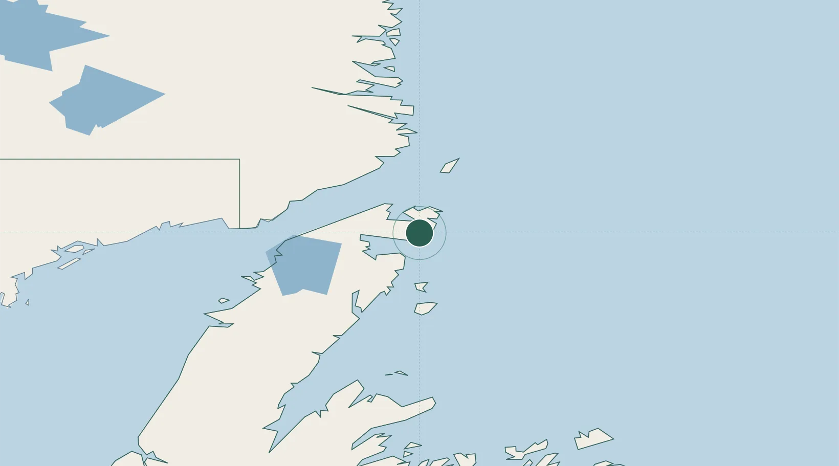
Nearby Logistics Neighbours

Cities
  1. 1Main Brook37 km
  2. 2Red Bay69 km
  3. 3Roddickton69 km
  4. 4L'Anse-au-Loup87 km
  5. 5Mary's Harbour105 km
Nearest neighbours — logibook spatial index (haversine) over the source coordinates
Ports
  1. 1Roddickton69 km
  2. 2Blanc Sablon106 km
  3. 3Baie Verte169 km
  4. 4Twillingate202 km
  5. 5Springdale212 km
Nearest neighbours — logibook spatial index (haversine) over the source coordinates
Airports
  1. 1St. Anthony Airport34 km
  2. 2Mary's Harbour Airport104 km
  3. 3St. Lewis (Fox Harbour) Airport110 km
  4. 4Lourdes-de-Blanc-Sablon Airport110 km
  5. 5Williams Harbour Airport132 km
Nearest neighbours — logibook spatial index (haversine) over the source coordinates
Trade Zones
  1. 1Crossroads Business Park281 km
  2. 2Cape Breton Regional Municipality Foreign Trade Zone692 km
  3. 3Halifax Gateway954 km
  4. 4FTZ No. 179 Madawaska1028 km
  5. 5Saint John1028 km
Nearest neighbours — logibook spatial index (haversine) over the source coordinates
DatabookThe Record of Consolidated Knowledge
Canada beyond logistics?
Browse databook

All Sources

LocationsUN/LOCODE
UN/LOCODE — free
Portsthe NGA World Port Index
Public domain (US gov)
AirportsOurAirports
Public domain
Trade Zonesthe World Bank SEZ database
CC BY 4.0
Trade ZonesOpen Zone Map
CC BY
← Canada locations