UN/LOCODE hub · Canada
CANLC

Centreville

48.9833°, -53.9000°
1
Transport functions

Transport Functions

Multimodal
UN/LOCODE

Hub Profile

Place type
Populated place
GeoNames
Region
Nova Scotia
GeoNames
Time zone
America/Glace_Bay
GeoNames
Elevation
7 m
GeoNames

Location

Location of CANLC
Natural Earth 10m (public domain) · Nova Scotia · CANLC · 48.98, -53.90GoogleOSMYandex

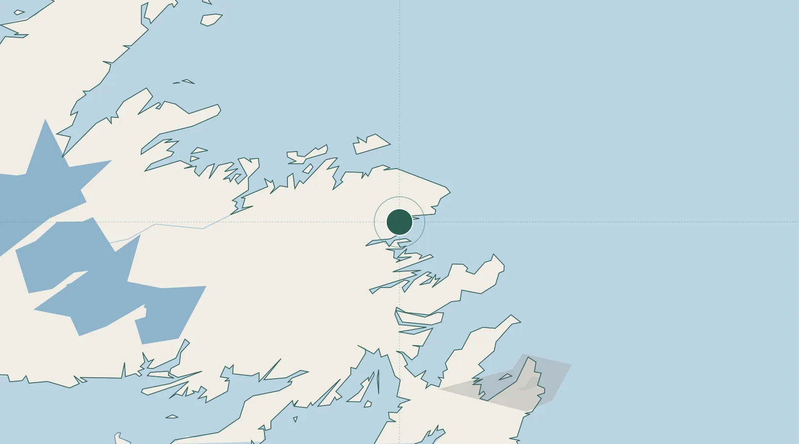
Nearby Logistics Neighbours

Cities
  1. 1Burnside32 km
  2. 2Gander48 km
  3. 3Carmanville50 km
  4. 4Seldom71 km
  5. 5Catalina79 km
Nearest neighbours — logibook spatial index (haversine) over the source coordinates
Ports
  1. 1Carmanville53 km
  2. 2Catalina Harbor80 km
  3. 3Lewisporte89 km
  4. 4Clarenville90 km
  5. 5Twillingate97 km
Nearest neighbours — logibook spatial index (haversine) over the source coordinates
Airports
  1. 1Gander International Airport49 km
  2. 2Fogo Airport79 km
  3. 3St. John's International Airport174 km
  4. 4Deer Lake Airport256 km
  5. 5Miquelon Airport279 km
Nearest neighbours — logibook spatial index (haversine) over the source coordinates
Trade Zones
  1. 1Crossroads Business Park50 km
  2. 2Cape Breton Regional Municipality Foreign Trade Zone601 km
  3. 3Halifax Gateway879 km
  4. 4Saint John1007 km
  5. 5FTZ No. 179 Madawaska1087 km
Nearest neighbours — logibook spatial index (haversine) over the source coordinates
DatabookThe Record of Consolidated Knowledge
Canada beyond logistics?
Browse databook

All Sources

LocationsUN/LOCODE
UN/LOCODE — free
Portsthe NGA World Port Index
Public domain (US gov)
AirportsOurAirports
Public domain
Trade Zonesthe World Bank SEZ database
CC BY 4.0
Trade ZonesOpen Zone Map
CC BY
← Canada locations