UN/LOCODE hub · Canada
CACKS

Cookshire

45.4000°, -71.6167°
1,021
Population
2
Transport functions

Transport Functions

Rail
Road
UN/LOCODE

Hub Profile

Place type
Populated place
GeoNames
Region
Quebec
GeoNames
Population
1,021
GeoNames
Time zone
America/Toronto
GeoNames
Elevation
237 m
GeoNames

Location

Location of CACKS
Natural Earth 10m (public domain) · Quebec · CACKS · 45.40, -71.62GoogleOSMYandex

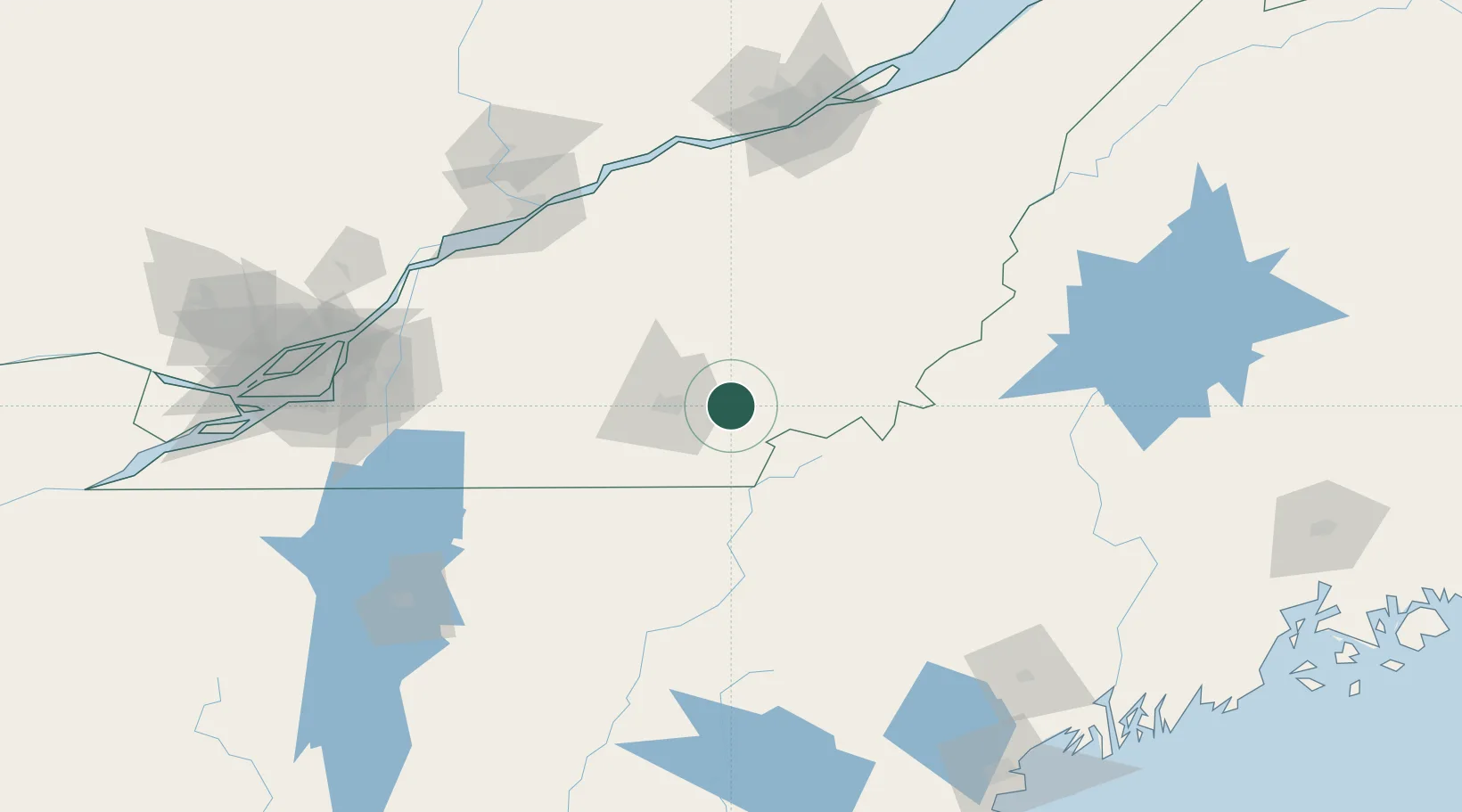
Nearby Logistics Neighbours

Cities
  1. 1East Angus10 km
  2. 2Saint-Isidore d'Auckland17 km
  3. 3Saint-Malo24 km
  4. 4Waterville25 km
  5. 5Windsor35 km
Nearest neighbours — logibook spatial index (haversine) over the source coordinates
Ports
  1. 1Port De Becancour126 km
  2. 2Trois Rivieres128 km
  3. 3Contrecour134 km
  4. 4Sorel137 km
  5. 5Montreal151 km
Nearest neighbours — logibook spatial index (haversine) over the source coordinates
Airports
  1. 1Sherbrooke Airport7 km
  2. 2Bromont (Roland Désourdy) Airport89 km
  3. 3Saint-Georges Airport104 km
  4. 4St Jean Airport131 km
  5. 5Trois-Rivières Airport134 km
Nearest neighbours — logibook spatial index (haversine) over the source coordinates
Trade Zones
  1. 1Greater Montreal Free Zone Center152 km
  2. 2Québec City FTZ161 km
  3. 3FTZ No. 186 Waterville178 km
  4. 4FTZ No. 263 Auburn183 km
  5. 5FTZ No. 058 Bangor229 km
Nearest neighbours — logibook spatial index (haversine) over the source coordinates
DatabookThe Record of Consolidated Knowledge
Canada beyond logistics?
Browse databook

All Sources

LocationsUN/LOCODE
UN/LOCODE — free
LocationsGeoNames
CC BY 4.0
Portsthe NGA World Port Index
Public domain (US gov)
AirportsOurAirports
Public domain
Trade Zonesthe World Bank SEZ database
CC BY 4.0
Trade ZonesOpen Zone Map
CC BY
← Canada locations