UN/LOCODE hub · Brazil
BRSOR

Sorocaba

-23.4833°, -47.4500°
687,357
Population
3
Transport functions

Transport Functions

Road
Airport
Multimodal
UN/LOCODE

Hub Profile

Place type
Provincial seat
GeoNames
Region
São Paulo
GeoNames
Population
687,357
GeoNames
Time zone
America/Sao_Paulo
GeoNames
Elevation
602 m
GeoNames

Location

Location of BRSOR
Natural Earth 10m (public domain) · São Paulo · BRSOR · -23.48, -47.45GoogleOSMYandex

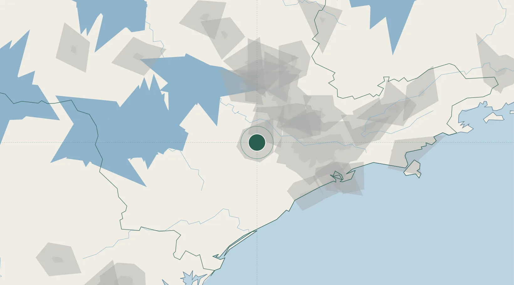
Nearby Logistics Neighbours

Cities
  1. 1Barueri60 km
  2. 2Jundiaí68 km
  3. 3Várzea Paulista72 km
  4. 4Sumaré76 km
  5. 5Campinas77 km
Nearest neighbours — logibook spatial index (haversine) over the source coordinates
Ports
  1. 1Santos128 km
  2. 2Sao Sebastiao212 km
  3. 3Paranagua249 km
  4. 4Angra Dos Reis324 km
  5. 5Sao Francisco330 km
Nearest neighbours — logibook spatial index (haversine) over the source coordinates
Airports
  1. 1Sorocaba Airport4 km
  2. 2São Paulo Catarina Executive Airport30 km
  3. 3Viracopos International Airport62 km
  4. 4Banespa República Heliport82 km
  5. 5Congonhas–Deputado Freitas Nobre Airport83 km
Nearest neighbours — logibook spatial index (haversine) over the source coordinates
Trade Zones
  1. 1ZPE de Itaguaí (RJ)381 km
  2. 2ZPE de Uberaba (MG)425 km
  3. 3ZPE de Fernandópolis (SP)458 km
  4. 4ZPE de Imbituba (SC)472 km
  5. 5ZPE de Bataguassú (MS)547 km
Nearest neighbours — logibook spatial index (haversine) over the source coordinates
DatabookThe Record of Consolidated Knowledge
Brazil beyond logistics?
Browse databook

All Sources

LocationsUN/LOCODE
UN/LOCODE — free
LocationsGeoNames
CC BY 4.0
Portsthe NGA World Port Index
Public domain (US gov)
AirportsOurAirports
Public domain
Trade Zonesthe World Bank SEZ database
CC BY 4.0
Trade ZonesOpen Zone Map
CC BY
← Brazil locations