Diversified Zone · China

Changshu Economic Development Zone Active

31.7531°, 120.9490°
464 ha
Zone area
1.5 km
Nearest port
35.8 km
Nearest airport

Gateway access

Nearest neighbours — logibook spatial index (haversine) over the source coordinates

Zone profile

Zone type
Diversified Zone
Open Zone Map
Region
Jiangsu
Open Zone Map
Status
Active
Open Zone Map
Management
Public
Open Zone Map
Operator
Management Commitiee
Open Zone Map
Legal framework
Founded in 1992, it was approved by the State Council as a state-level economic and technological development zone in November 2010
Open Zone Map

Location

Location of ozm-516
Natural Earth 10m (public domain) · Jiangsu · ozm-516 · 31.75, 120.95GoogleOSMYandex

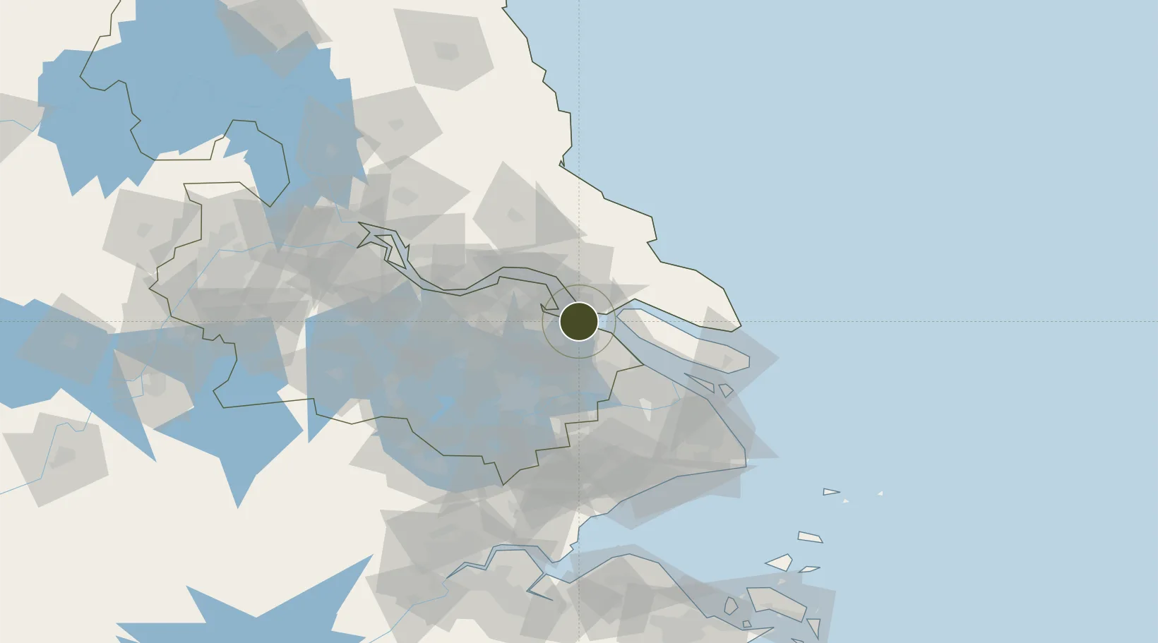
Nearby Logistics Neighbours

Ports
  1. 1Changshu2 km
  2. 2Taicang26 km
  3. 3Nantong31 km
  4. 4Zhangjiangang57 km
  5. 5Jiangyin70 km
Nearest neighbours — logibook spatial index (haversine) over the source coordinates
Airports
  1. 1Nantong Xingdong International Airport36 km
  2. 2Sunan Shuofang International Airport57 km
  3. 3Chenghu General Airport62 km
  4. 4Shanghai Dachang Air Base65 km
  5. 5Rugao Air Base70 km
Nearest neighbours — logibook spatial index (haversine) over the source coordinates
Cities
  1. 1Changshu Pt7 km
  2. 2Nantong22 km
  3. 3Chongming28 km
  4. 4Taicang Pt28 km
  5. 5Zouxiang28 km
Nearest neighbours — logibook spatial index (haversine) over the source coordinates
Trade Zones
  1. 1Chongchuan Economic Development Zone21 km
  2. 2Jiangsu Changshu Southeast Economic Development Zone22 km
  3. 3Haimen Industrial Park29 km
  4. 4Haimen Economic Development Zone30 km
  5. 5Taicang Economic Development Zone (New Zone)31 km
Nearest neighbours — logibook spatial index (haversine) over the source coordinates
DatabookThe Record of Consolidated Knowledge
China beyond logistics?
Browse databook

All Sources

Trade ZonesOpen Zone Map
CC BY
Portsthe NGA World Port Index
Public domain (US gov)
AirportsOurAirports
Public domain
LocationsUN/LOCODE
UN/LOCODE — free
← China trade zones