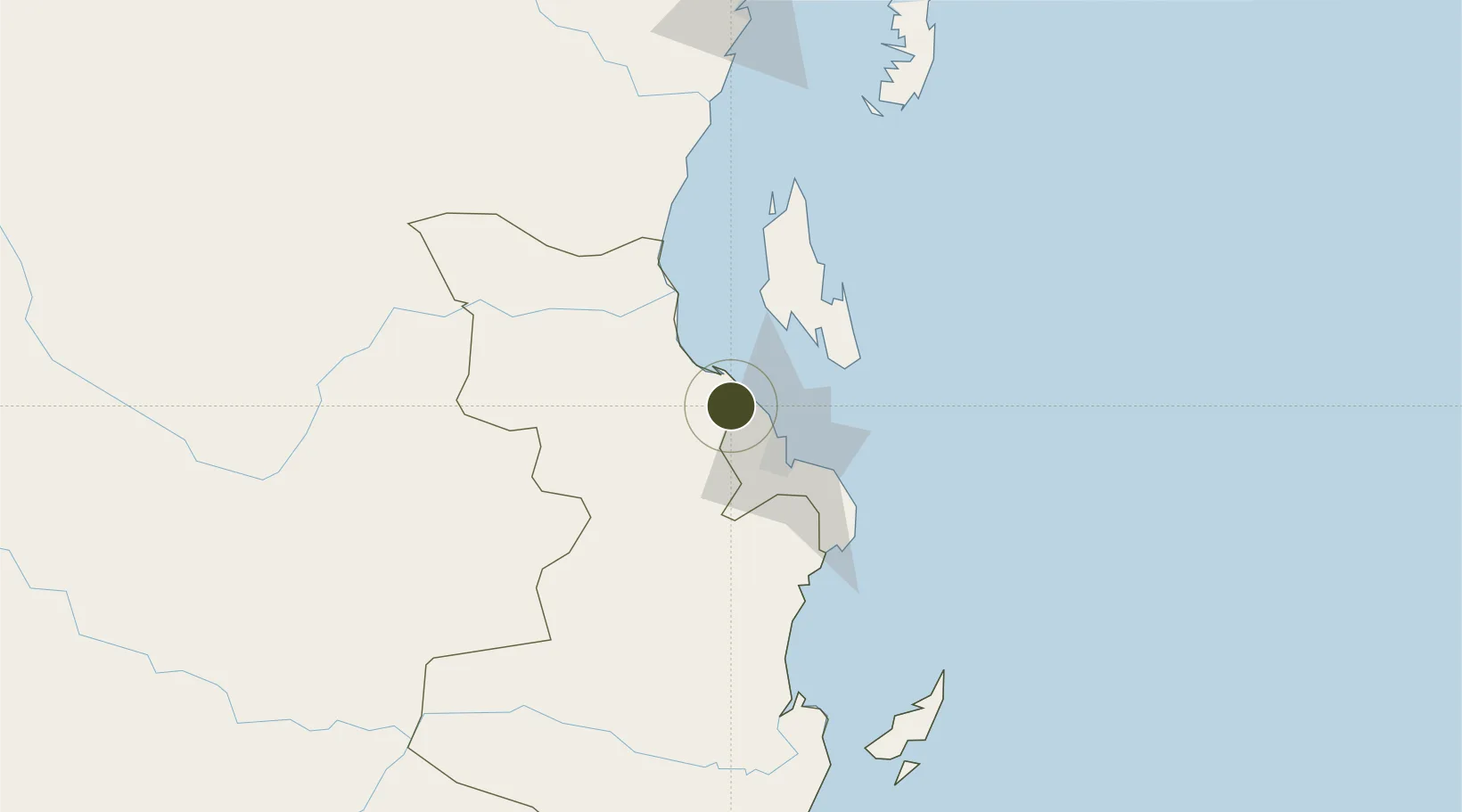
Specialized Zone · Tanzania

Kamal Industrial Park Active

-6.6080°, 39.0640°
113 ha
Zone area
34.9 km
Nearest port
33.5 km
Nearest airport

Gateway access

Nearest neighbours — logibook spatial index (haversine) over the source coordinates

Zone profile

Zone type
Specialized Zone
Open Zone Map
Specialization
Chemical
Open Zone Map
Region
Pwani
Open Zone Map
Status
Active
Open Zone Map
Management
Public
Open Zone Map
Operator
State Owned
Open Zone Map
Legal framework
Special Economic Zones Act of 2006
Open Zone Map

Location

Location of ozm-4432
Natural Earth 10m (public domain) · Pwani · ozm-4432 · -6.61, 39.06GoogleOSMYandex

Nearby Logistics Neighbours

Ports
  1. 1Dar Es Salaam35 km
  2. 2Zanzibar51 km
  3. 3Tanga170 km
  4. 4Kilwa Kivinje240 km
  5. 5Mombasa290 km
Nearest neighbours — logibook spatial index (haversine) over the source coordinates
Airports
  1. 1Julius Nyerere International Airport34 km
  2. 2Abeid Amani Karume International Airport47 km
  3. 3Mafia Airport160 km
  4. 4Tanga Airport169 km
  5. 5Pemba Airport171 km
Nearest neighbours — logibook spatial index (haversine) over the source coordinates
Cities
  1. 1Kibaha24 km
  2. 2African Inland Container Depot31 km
  3. 3Dar es Salaam33 km
  4. 4Zanzibar52 km
  5. 5Ikwiriri153 km
Nearest neighbours — logibook spatial index (haversine) over the source coordinates
Trade Zones
  1. 1Kamal Industrial Estate7 km
  2. 2Kibaha Textile Special Economic Zone20 km
  3. 3Hidafhi Export Processing Zone27 km
  4. 4Ujiji Export Processing Zone27 km
  5. 5Millenium Business Park Export Processing Zone27 km
Nearest neighbours — logibook spatial index (haversine) over the source coordinates
DatabookThe Record of Consolidated Knowledge
Tanzania beyond logistics?
Browse databook

All Sources

Trade ZonesOpen Zone Map
CC BY
Portsthe NGA World Port Index
Public domain (US gov)
AirportsOurAirports
Public domain
LocationsUN/LOCODE
UN/LOCODE — free
← Tanzania trade zones