Export Processing Zone · Tanzania

Neema Export Processing Zone Under Development
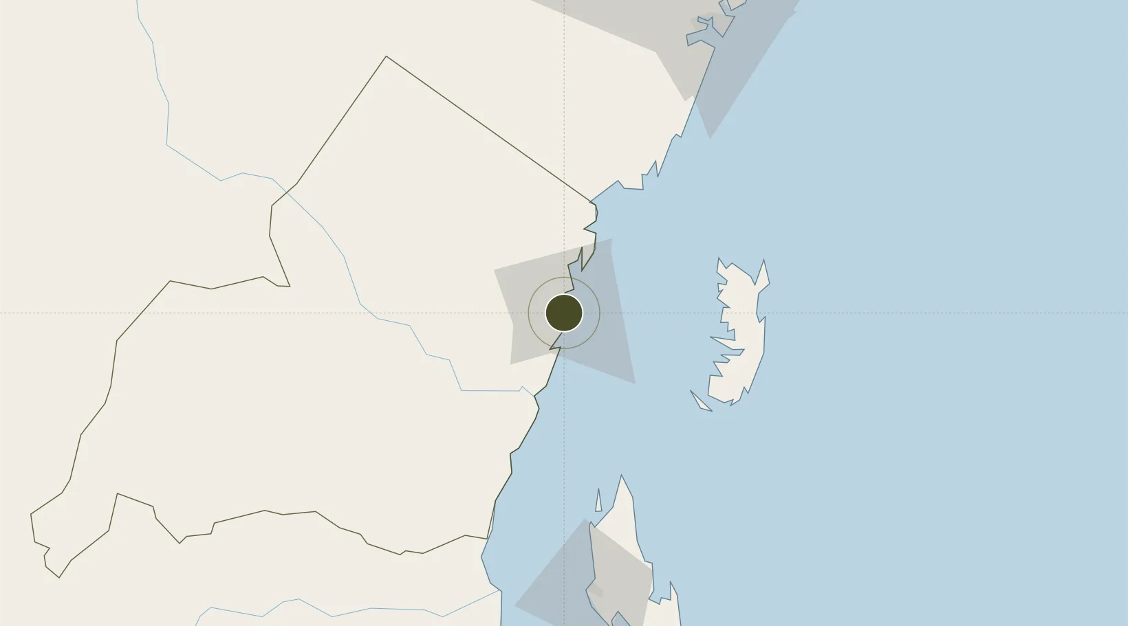
-5.1002°, 39.0943°
2,000 ha
Zone area
3.1 km
Nearest port
2.7 km
Nearest airport

Gateway access

Nearest neighbours — logibook spatial index (haversine) over the source coordinates

Zone profile

Zone type
Export Processing Zone
Open Zone Map
Region
Tanga
Open Zone Map
Status
Under Development
Open Zone Map
Management
Public
Open Zone Map
Operator
Export Processing Zone Authority
Open Zone Map
Legal framework
Special Economic Zones Act of 2006
Open Zone Map

Location

Location of ozm-4416
Natural Earth 10m (public domain) · Tanga · ozm-4416 · -5.10, 39.09GoogleOSMYandex

Nearby Logistics Neighbours

Ports
  1. 1Tanga3 km
  2. 2Zanzibar119 km
  3. 3Mombasa131 km
  4. 4Kilifi184 km
  5. 5Dar Es Salaam192 km
Nearest neighbours — logibook spatial index (haversine) over the source coordinates
Airports
  1. 1Tanga Airport3 km
  2. 2Pemba Airport81 km
  3. 3Abeid Amani Karume International Airport126 km
  4. 4Moi International Airport131 km
  5. 5Julius Nyerere International Airport198 km
Nearest neighbours — logibook spatial index (haversine) over the source coordinates
Cities
  1. 1Tanga4 km
  2. 2Shimoni59 km
  3. 3Zanzibar118 km
  4. 4Mombasa133 km
  5. 5Kibaha186 km
Nearest neighbours — logibook spatial index (haversine) over the source coordinates
Trade Zones
  1. 1Neema Tanga Special Economic Zone2 km
  2. 2Kange Industrial Park8 km
  3. 3Pongwe-Tanga Economic Corridor8 km
  4. 4Pongwe Industrial Park13 km
  5. 5Mkinga Special Economic Zone23 km
Nearest neighbours — logibook spatial index (haversine) over the source coordinates
DatabookThe Record of Consolidated Knowledge
Tanzania beyond logistics?
Browse databook

All Sources

Trade ZonesOpen Zone Map
CC BY
Portsthe NGA World Port Index
Public domain (US gov)
AirportsOurAirports
Public domain
LocationsUN/LOCODE
UN/LOCODE — free
← Tanzania trade zones