Export Processing Zone · Philippines

Barotac Nuevo Industry & Economic Park Under Development
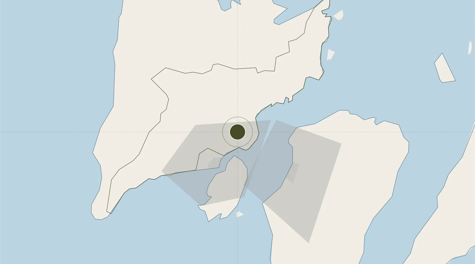
10.8837°, 122.6873°
50 ha
Zone area
23.4 km
Nearest port
21.9 km
Nearest airport

Gateway access

Nearest neighbours — logibook spatial index (haversine) over the source coordinates

Zone profile

Zone type
Export Processing Zone
Open Zone Map
Region
Iloilo
Open Zone Map
Status
Under Development
Open Zone Map
Management
Private
Open Zone Map
Operator
Don Jose Sustiguer Monfort Memorial Nat'l. College
Open Zone Map
Legal framework
Special Economic Zone Act (Republic Act No. 7916) (as amended by Republic Act No. 8748)
Open Zone Map

Location

Location of ozm-3251
Natural Earth 10m (public domain) · Iloilo · ozm-3251 · 10.88, 122.69GoogleOSMYandex

Nearby Logistics Neighbours

Ports
  1. 1Iloilo23 km
  2. 2Pulupandan43 km
  3. 3Port Capiz80 km
  4. 4San Carlos91 km
  5. 5Toledo118 km
Nearest neighbours — logibook spatial index (haversine) over the source coordinates
Airports
  1. 1Iloilo International Airport22 km
  2. 2Bacolod-Silay International Airport38 km
  3. 3Roxas Airport80 km
  4. 4Evelio Javier Airport84 km
  5. 5Kalibo International Airport95 km
Nearest neighbours — logibook spatial index (haversine) over the source coordinates
Cities
  1. 1Iloilo, Panay23 km
  2. 2Bacolod, Negros36 km
  3. 3Ajuy49 km
  4. 4La Carlota58 km
  5. 5Culasi80 km
Nearest neighbours — logibook spatial index (haversine) over the source coordinates
Trade Zones
  1. 1Dumangas Agro-Industrial Zone7 km
  2. 2Leganes Industrial Growth Center16 km
  3. 3Iloilo Gateway Cyberscape20 km
  4. 4Bamboo Technology & Development Park21 km
  5. 5Pavia Special Economic Zone23 km
Nearest neighbours — logibook spatial index (haversine) over the source coordinates
DatabookThe Record of Consolidated Knowledge
Philippines beyond logistics?
Browse databook

All Sources

Trade ZonesOpen Zone Map
CC BY
Portsthe NGA World Port Index
Public domain (US gov)
AirportsOurAirports
Public domain
LocationsUN/LOCODE
UN/LOCODE — free
← Philippines trade zones