Diversified Zone · Pakistan

Hub Special Economic Zone Under Development
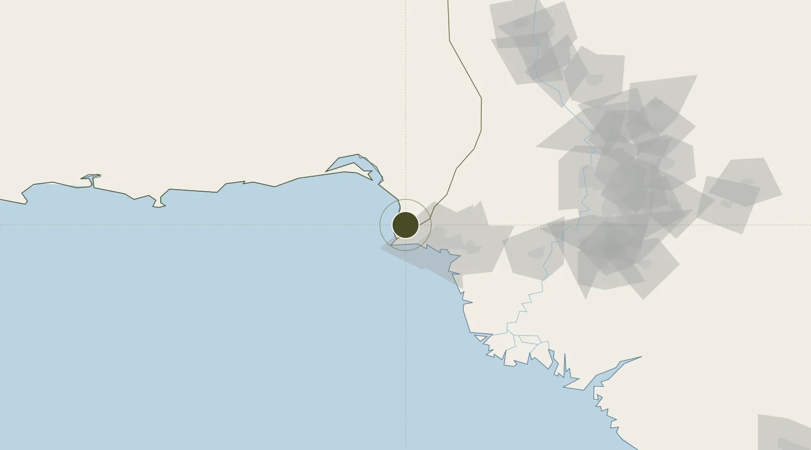
25.0140°, 66.7825°
164 ha
Zone area
32.7 km
Nearest port
20.7 km
Nearest airport

Gateway access

Nearest neighbours — logibook spatial index (haversine) over the source coordinates

Zone profile

Zone type
Diversified Zone
Open Zone Map
Region
Baluchistan
Open Zone Map
Status
Under Development
Open Zone Map
Management
Public
Open Zone Map
Operator
Planning & Development Department, Governmet of Balochistan
Open Zone Map
Legal framework
Special Economic Zones Act, 2012
Open Zone Map

Location

Location of ozm-3028
Natural Earth 10m (public domain) · Baluchistan · ozm-3028 · 25.01, 66.78GoogleOSMYandex

Nearby Logistics Neighbours

Ports
  1. 1Karachi33 km
  2. 2Muhamamad Bin Qasim64 km
  3. 3Mandvi356 km
  4. 4Okha367 km
  5. 5Mundra391 km
Nearest neighbours — logibook spatial index (haversine) over the source coordinates
Airports
  1. 1Masroor Air Base21 km
  2. 2Faisal Air Base37 km
  3. 3Jinnah International Airport40 km
  4. 4Hyderabad Airport163 km
  5. 5Sehwan Sharif Airport187 km
Nearest neighbours — logibook spatial index (haversine) over the source coordinates
Cities
  1. 1Karachi Container Terminal27 km
  2. 2Kiamari29 km
  3. 3Karachi Freight Terminal30 km
  4. 4Karachi30 km
  5. 5Muhammad Bin Qasim/Karachi61 km
Nearest neighbours — logibook spatial index (haversine) over the source coordinates
Trade Zones
  1. 1Korangi Creek Industrial Park40 km
  2. 2Karachi Export Processing Zone50 km
  3. 3Karachi Export Processing Zone51 km
  4. 4Quaid-E-Azim Apparel Park58 km
  5. 5Al-Tuwairqi Steel Mill Export Processing Zone60 km
Nearest neighbours — logibook spatial index (haversine) over the source coordinates
DatabookThe Record of Consolidated Knowledge
Pakistan beyond logistics?
Browse databook

All Sources

Trade ZonesOpen Zone Map
CC BY
Portsthe NGA World Port Index
Public domain (US gov)
AirportsOurAirports
Public domain
LocationsUN/LOCODE
UN/LOCODE — free
← Pakistan trade zones