Seaport · United Kingdom

ObanGBOBA

56.4167°, -5.4667°
12.5 m
Channel depth
Oban is also a UN/LOCODE logistics hub →

Channel & Berth Profile

SEA LEVEL (CD)CHANNEL BEDCargo pier · 3.4 mAnchorage · 11.0 mChannel · 12.5 m
NGA World Port Index

Pilotage, Tugs & Services

Pilotage availableYES
Local assistanceYES
Potable waterYES
Diesel bunkersYES
MedicalYES
NGA World Port Index

Facilities & Capabilities

Container
Ro-Ro
Liquid bulk
Dry bulk
Oil terminal
Break bulk
Dry dock
RepairsNO
BunkeringYES
Rail linkYES
Dangerous cargo
ISPS security
NGA World Port Index

Harbour Specifications

Harbour size
Small
NGA World Port Index
Harbour type
Coastal (Natural)
NGA World Port Index
Shelter
Excellent
NGA World Port Index
Water body
North Atlantic Ocean
NGA World Port Index
Tidal range
3 m
NGA World Port Index

Location

Location of GBOBA
Natural Earth 10m (public domain) · Argyll and Bute · GBOBA · 56.42, -5.47GoogleOSMYandex

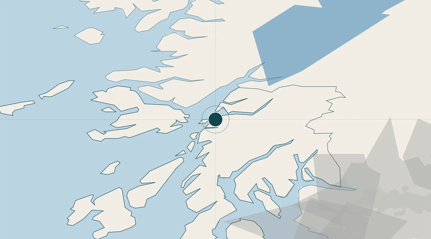
Nearby Logistics Neighbours

Ports
  1. 1Craignure15 km
  2. 2Glensanda17 km
  3. 3Lochaline24 km
  4. 4Crinan (Canal)38 km
  5. 5Tobermory43 km
Nearest neighbours — logibook spatial index (haversine) over the source coordinates
Cities
  1. 1Lismore Island9 km
  2. 2Achnacroish9 km
  3. 3Point, Island of Lismore15 km
  4. 4Barcaldine15 km
  5. 5Port Appin15 km
Nearest neighbours — logibook spatial index (haversine) over the source coordinates
Airports
  1. 1Oban Airport7 km
  2. 2Colonsay Airstrip62 km
  3. 3Coll Airport74 km
  4. 4Tiree Airport87 km
  5. 5Glasgow Airport88 km
Nearest neighbours — logibook spatial index (haversine) over the source coordinates
Trade Zones
  1. 1Prestwick Airport Free Zone114 km
  2. 2Carlisle Kingmoor Park Enterprise Zone228 km
  3. 3Isle of Man Free Zone and Business Park264 km
  4. 4North Eastern Enterprise Zone290 km
  5. 5Blackpool Enterprise Zone332 km
Nearest neighbours — logibook spatial index (haversine) over the source coordinates
DatabookThe Record of Consolidated Knowledge
United Kingdom beyond logistics?
Browse databook

All Sources

Portsthe NGA World Port Index
Public domain (US gov)
AirportsOurAirports
Public domain
LocationsUN/LOCODE
UN/LOCODE — free
Trade Zonesthe World Bank SEZ database
CC BY 4.0
Trade ZonesOpen Zone Map
CC BY
← United Kingdom ports