UN/LOCODE hub · United States
USSO9

Stookey

38.5000°, -90.0833°
2
Transport functions

Transport Functions

Port
Multimodal
UN/LOCODE

Hub Profile

Region
IL
GeoNames

Location

Location of USSO9
Natural Earth 10m (public domain) · IL · USSO9 · 38.50, -90.08GoogleOSMYandex

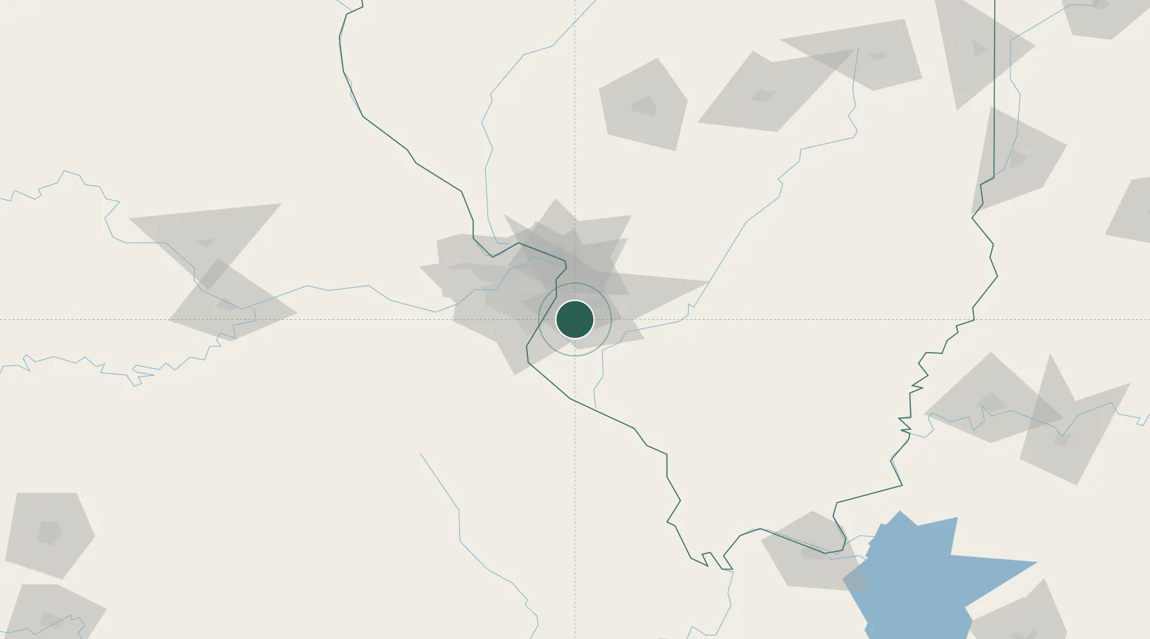
Nearby Logistics Neighbours

Cities
  1. 1Millstadt4 km
  2. 2Centreville9 km
  3. 3Swansea10 km
  4. 4Dupo10 km
  5. 5Columbia12 km
Nearest neighbours — logibook spatial index (haversine) over the source coordinates
Ports
  1. 1Port Of Memphis382 km
  2. 2Indiana Harbor418 km
  3. 3Gary418 km
  4. 4Calumet Harbor421 km
  5. 5Chicago431 km
Nearest neighbours — logibook spatial index (haversine) over the source coordinates
Airports
  1. 1Scott AFB/Midamerica Airport22 km
  2. 2St. Louis Lambert International Airport37 km
  3. 3St Louis Regional Airport44 km
  4. 4Spirit of St Louis Airport53 km
  5. 5Southern Illinois Airport108 km
Nearest neighbours — logibook spatial index (haversine) over the source coordinates
Trade Zones
  1. 1FTZ No. 031 Granite City29 km
  2. 2FTZ No. 102 St. Louis County57 km
  3. 3FTZ No. 245 Decatur175 km
  4. 4FTZ No. 294 Western Kentucky207 km
  5. 5FTZ No. 177 Evansville223 km
Nearest neighbours — logibook spatial index (haversine) over the source coordinates
DatabookThe Record of Consolidated Knowledge
United States beyond logistics?
Browse databook

All Sources

LocationsUN/LOCODE
UN/LOCODE — free
Portsthe NGA World Port Index
Public domain (US gov)
AirportsOurAirports
Public domain
Trade Zonesthe World Bank SEZ database
CC BY 4.0
Trade ZonesOpen Zone Map
CC BY
← United States locations