UN/LOCODE hub · Ukraine
UAYUZ

Pivdennyi

46.6564°, 31.0100°
1
Transport functions
1
Container terminals

Transport Functions

Port
UN/LOCODE

Hub Profile

Place type
Urban district
GeoNames
Region
Kirovohrad
GeoNames
Time zone
Europe/Kyiv
GeoNames
Elevation
114 m
GeoNames
Logistics facilities
1
UN/LOCODE
Container terminals
1
UN/LOCODE

Location

Location of UAYUZ
Natural Earth 10m (public domain) · Kirovohrad · UAYUZ · 46.66, 31.01GoogleOSMYandex

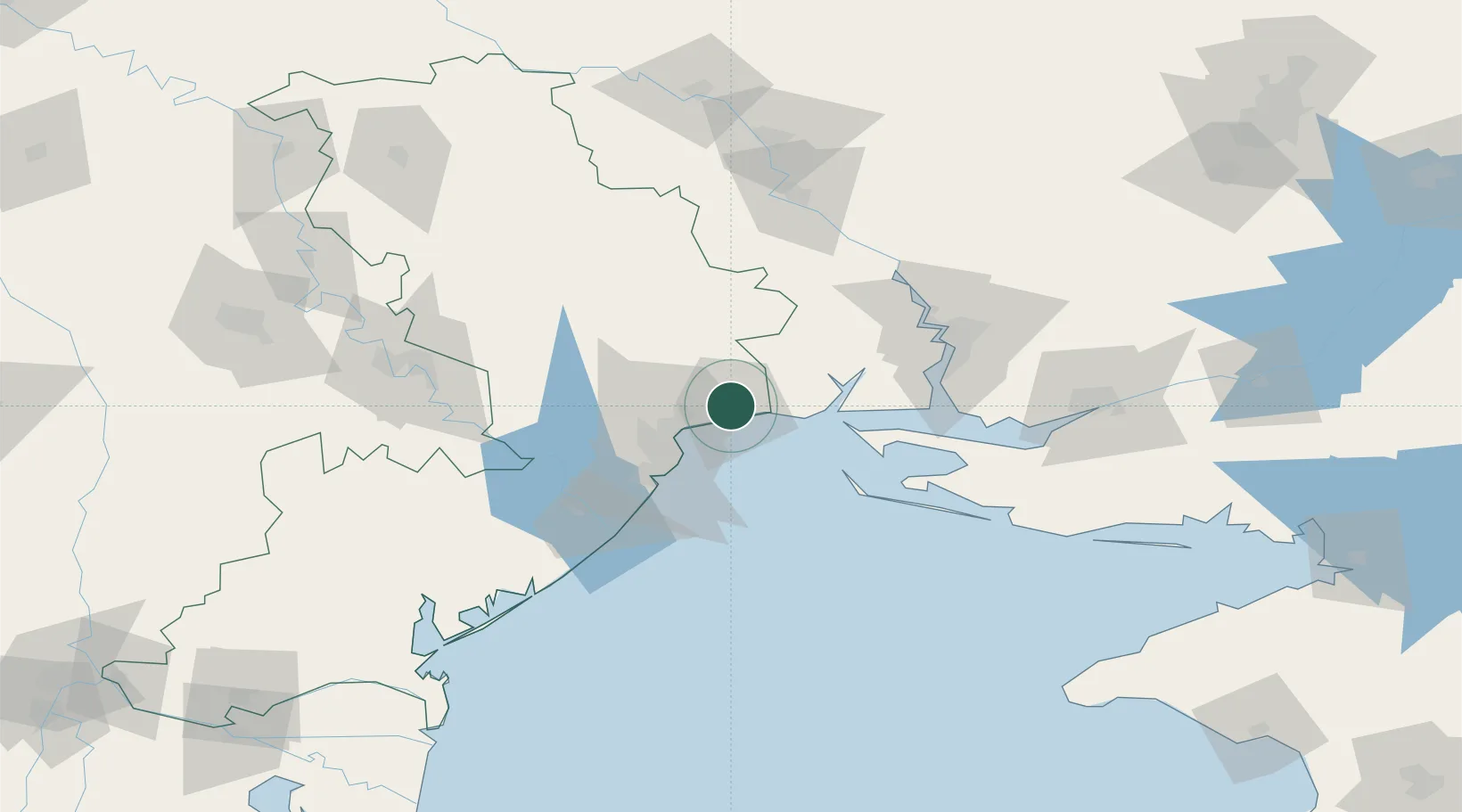
Nearby Logistics Neighbours

Cities
  1. 1Odesa26 km
  2. 2Chornomorsk41 km
  3. 3Ochakiv43 km
  4. 4Kamenka58 km
  5. 5Bilhorod-Dnistrovskyi72 km
Nearest neighbours — logibook spatial index (haversine) over the source coordinates
Ports
  1. 1Yuzhnyy6 km
  2. 2Odesa29 km
  3. 3Illichivsk48 km
  4. 4Belgorod-Dnestrovsky72 km
  5. 5Port Oktyabrsk73 km
Nearest neighbours — logibook spatial index (haversine) over the source coordinates
Airports
  1. 1Odesa International Airport36 km
  2. 2Mykolaiv International Airport82 km
  3. 3Tiraspol Airfield111 km
  4. 4Kherson International Airport114 km
  5. 5Chişinău International Airport161 km
Nearest neighbours — logibook spatial index (haversine) over the source coordinates
Trade Zones
  1. 1Porto Franco Special Economic Zone28 km
  2. 2Special Economic Zone Nikolaev (Mykolaiv)83 km
  3. 3Expo Business Chisinau159 km
  4. 4Free Enterprise Zone Tvardita166 km
  5. 5Free Enterprise Zone - Production Park Valkaneş171 km
Nearest neighbours — logibook spatial index (haversine) over the source coordinates
DatabookThe Record of Consolidated Knowledge
Ukraine beyond logistics?
Browse databook

All Sources

LocationsUN/LOCODE
UN/LOCODE — free
Portsthe NGA World Port Index
Public domain (US gov)
AirportsOurAirports
Public domain
Trade Zonesthe World Bank SEZ database
CC BY 4.0
Trade ZonesOpen Zone Map
CC BY
← Ukraine locations