UN/LOCODE hub · Türkiye
TRDIK

Dikili

39.0667°, 26.8833°
14,125
Population
1
Transport functions

Transport Functions

Port
Dikili is also a profiled seaport →
UN/LOCODE

Hub Profile

Place type
Provincial seat
GeoNames
Region
İzmir Province
GeoNames
Population
14,125
GeoNames
Time zone
Europe/Istanbul
GeoNames
Elevation
8 m
GeoNames

Location

Location of TRDIK
Natural Earth 10m (public domain) · İzmir Province · TRDIK · 39.07, 26.88GoogleOSMYandex

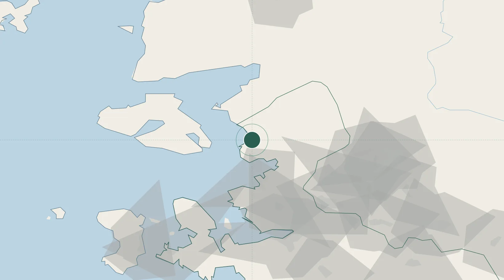
Nearby Logistics Neighbours

Cities
  1. 1Mytilene29 km
  2. 2Ayvalik33 km
  3. 3Perama Geras Mytilinis33 km
  4. 4Aliaga35 km
  5. 5Plomárion46 km
Nearest neighbours — logibook spatial index (haversine) over the source coordinates
Ports
  1. 1Aliaga26 km
  2. 2Mitilini28 km
  3. 3Ayvalik32 km
  4. 4Nemrut Limani Bay34 km
  5. 5Plomarion46 km
Nearest neighbours — logibook spatial index (haversine) over the source coordinates
Airports
  1. 1Mytilene International Airport25 km
  2. 2Balıkesir Koca Seyit Airport55 km
  3. 3Çiğli Airbase63 km
  4. 4Akhisar Airport / Akhisar Air Base87 km
  5. 5Adnan Menderes International Airport89 km
Nearest neighbours — logibook spatial index (haversine) over the source coordinates
Trade Zones
  1. 1Aliaga Kimya Ihtisas ve Karma Organized Industrial Zone31 km
  2. 2Izmir Free Zone50 km
  3. 3Manisa Organized Industrial Zone65 km
  4. 4Izmir Ataturk Organized Industrial Zone65 km
  5. 5Aegean Free Zone84 km
Nearest neighbours — logibook spatial index (haversine) over the source coordinates
DatabookThe Record of Consolidated Knowledge
Türkiye beyond logistics?
Browse databook

All Sources

LocationsUN/LOCODE
UN/LOCODE — free
LocationsGeoNames
CC BY 4.0
Portsthe NGA World Port Index
Public domain (US gov)
AirportsOurAirports
Public domain
Trade Zonesthe World Bank SEZ database
CC BY 4.0
Trade ZonesOpen Zone Map
CC BY
← Türkiye locations