UN/LOCODE hub · Greece
GRPLM

Plomárion

38.9833°, 26.3667°
2
Transport functions

Transport Functions

Port
Road
Plomárion is also a profiled seaport →
UN/LOCODE

Hub Profile

Region
83
GeoNames

Location

Location of GRPLM
Natural Earth 10m (public domain) · 83 · GRPLM · 38.98, 26.37GoogleOSMYandex

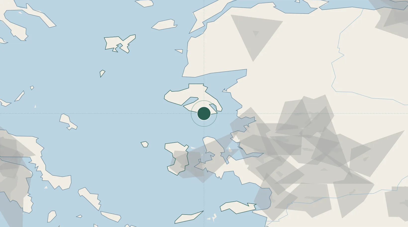
Nearby Logistics Neighbours

Cities
  1. 1Perama Geras Mytilinis13 km
  2. 2Mytilene21 km
  3. 3Petra42 km
  4. 4Dikili46 km
  5. 5Ayvalik46 km
Nearest neighbours — logibook spatial index (haversine) over the source coordinates
Ports
  1. 1Mitilini22 km
  2. 2Dikili39 km
  3. 3Ayvalik47 km
  4. 4Aliaga52 km
  5. 5Nemrut Limani Bay53 km
Nearest neighbours — logibook spatial index (haversine) over the source coordinates
Airports
  1. 1Mytilene International Airport22 km
  2. 2Chios Island National Airport74 km
  3. 3Çiğli Airbase77 km
  4. 4Balıkesir Koca Seyit Airport84 km
  5. 5Adnan Menderes International Airport103 km
Nearest neighbours — logibook spatial index (haversine) over the source coordinates
Trade Zones
  1. 1Aliaga Kimya Ihtisas ve Karma Organized Industrial Zone62 km
  2. 2Izmir Free Zone64 km
  3. 3Izmir Ataturk Organized Industrial Zone80 km
  4. 4Manisa Organized Industrial Zone96 km
  5. 5Aegean Free Zone97 km
Nearest neighbours — logibook spatial index (haversine) over the source coordinates
DatabookThe Record of Consolidated Knowledge
Greece beyond logistics?
Browse databook

All Sources

LocationsUN/LOCODE
UN/LOCODE — free
Portsthe NGA World Port Index
Public domain (US gov)
AirportsOurAirports
Public domain
Trade Zonesthe World Bank SEZ database
CC BY 4.0
Trade ZonesOpen Zone Map
CC BY
← Greece locations