UN/LOCODE hub · Sweden
SESMD

Strömstad

58.9333°, 11.1833°
3
Transport functions

Transport Functions

Port
Rail
Road
Strömstad is also a profiled seaport →
UN/LOCODE

Hub Profile

Region
O
GeoNames

Location

Location of SESMD
Natural Earth 10m (public domain) · O · SESMD · 58.93, 11.18GoogleOSMYandex

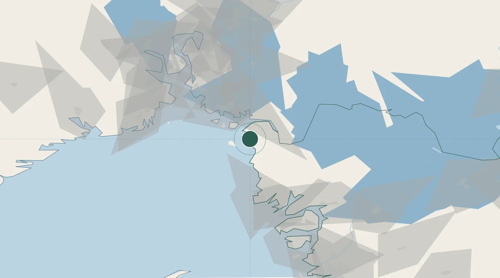
Nearby Logistics Neighbours

Cities
  1. 1Skjærhalden13 km
  2. 2Kalvik15 km
  3. 3Halden21 km
  4. 4Utgårdskilen25 km
  5. 5Fredrikstad31 km
Nearest neighbours — logibook spatial index (haversine) over the source coordinates
Ports
  1. 1Halden23 km
  2. 2Grebbestad29 km
  3. 3Fredrikstad30 km
  4. 4Sarpsborg37 km
  5. 5Fjallbacka37 km
Nearest neighbours — logibook spatial index (haversine) over the source coordinates
Airports
  1. 1Moss Airport, Rygge55 km
  2. 2Sandefjord Airport, Torp60 km
  3. 3Trollhättan-Vänersborg Airport96 km
  4. 4Skien Airport97 km
  5. 5Såtenäs Air Base105 km
Nearest neighbours — logibook spatial index (haversine) over the source coordinates
Trade Zones
  1. 1Gothenburg Boundless Customs Warehouse141 km
  2. 2Jönköping Free Zone214 km
  3. 3Freeport of Copenhagen- Nordhavn368 km
  4. 4MTS Malmö Transport and Spedition387 km
  5. 5Stockholm Free Zone398 km
Nearest neighbours — logibook spatial index (haversine) over the source coordinates
DatabookThe Record of Consolidated Knowledge
Sweden beyond logistics?
Browse databook

All Sources

LocationsUN/LOCODE
UN/LOCODE — free
Portsthe NGA World Port Index
Public domain (US gov)
AirportsOurAirports
Public domain
Trade Zonesthe World Bank SEZ database
CC BY 4.0
Trade ZonesOpen Zone Map
CC BY
← Sweden locations