UN/LOCODE hub · Sweden
SESLG

Slöinge

56.8500°, 12.6833°
2
Transport functions

Transport Functions

Rail
Road
UN/LOCODE

Hub Profile

Region
N
GeoNames

Location

Location of SESLG
Natural Earth 10m (public domain) · N · SESLG · 56.85, 12.68GoogleOSMYandex

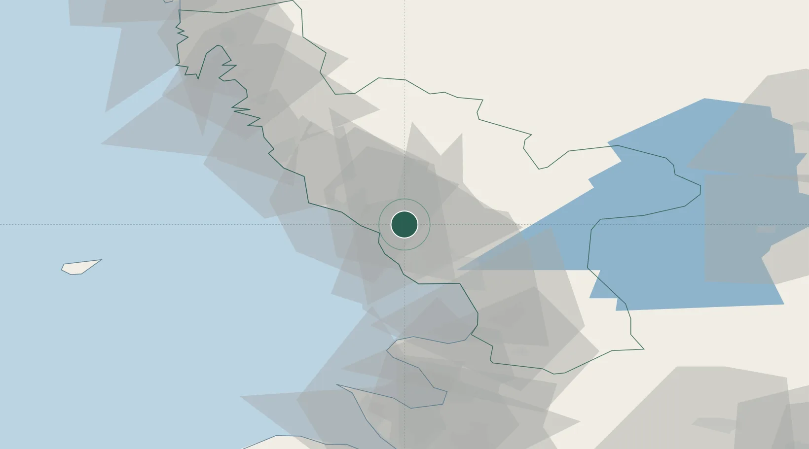
Nearby Logistics Neighbours

Cities
  1. 1Falkenberg12 km
  2. 2Holm17 km
  3. 3Langas21 km
  4. 4Glommen22 km
  5. 5Halmstad24 km
Nearest neighbours — logibook spatial index (haversine) over the source coordinates
Ports
  1. 1Falkenberg14 km
  2. 2Halmstad23 km
  3. 3Varberg40 km
  4. 4Nykobing (Mor)51 km
  5. 5Hoganas73 km
Nearest neighbours — logibook spatial index (haversine) over the source coordinates
Airports
  1. 1Halmstad Airport20 km
  2. 2Ängelholm-Helsingborg Airport62 km
  3. 3Anholt Airfield71 km
  4. 4Ljungbyhed Airfield91 km
  5. 5Göteborg Landvetter Airport94 km
Nearest neighbours — logibook spatial index (haversine) over the source coordinates
Trade Zones
  1. 1Gothenburg Boundless Customs Warehouse109 km
  2. 2Freeport of Copenhagen- Nordhavn126 km
  3. 3Jönköping Free Zone133 km
  4. 4MTS Malmö Transport and Spedition141 km
  5. 5Freeport of Kiel321 km
Nearest neighbours — logibook spatial index (haversine) over the source coordinates
DatabookThe Record of Consolidated Knowledge
Sweden beyond logistics?
Browse databook

All Sources

LocationsUN/LOCODE
UN/LOCODE — free
Portsthe NGA World Port Index
Public domain (US gov)
AirportsOurAirports
Public domain
Trade Zonesthe World Bank SEZ database
CC BY 4.0
Trade ZonesOpen Zone Map
CC BY
← Sweden locations