UN/LOCODE hub · Sweden
SESK8

Sickla

59.3000°, 18.1167°
1
Transport functions

Transport Functions

Rail
UN/LOCODE

Hub Profile

Place type
Populated place
GeoNames
Region
Stockholm
GeoNames
Time zone
Europe/Stockholm
GeoNames
Elevation
26 m
GeoNames

Location

Location of SESK8
Natural Earth 10m (public domain) · Stockholm · SESK8 · 59.30, 18.12GoogleOSMYandex

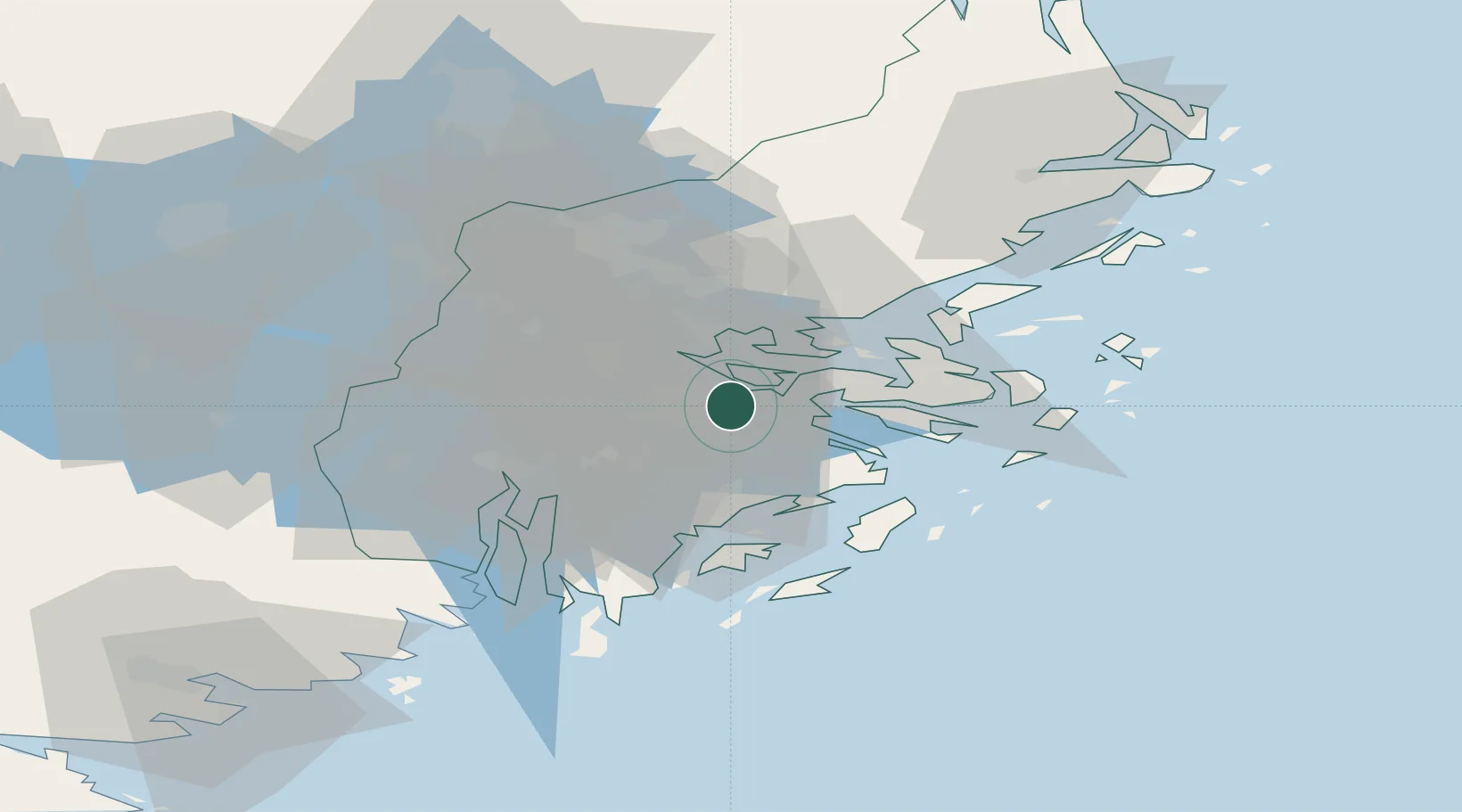
Nearby Logistics Neighbours

Cities
  1. 1Bergs oljehamn3 km
  2. 2Trangsund8 km
  3. 3Älvsjö/Stockholm8 km
  4. 4Tomteboda/Solna8 km
  5. 5Stockholm9 km
Nearest neighbours — logibook spatial index (haversine) over the source coordinates
Ports
  1. 1Stockholm5 km
  2. 2Gustavsberg15 km
  3. 3Sodertalje30 km
  4. 4Nynashamn45 km
  5. 5Hallstavik87 km
Nearest neighbours — logibook spatial index (haversine) over the source coordinates
Airports
  1. 1Stockholm-Bromma Airport12 km
  2. 2Stockholm-Arlanda Airport40 km
  3. 3Eskilstuna Airport80 km
  4. 4Stockholm Skavsta Airport89 km
  5. 5Stockholm Västerås Airport90 km
Nearest neighbours — logibook spatial index (haversine) over the source coordinates
Trade Zones
  1. 1Stockholm Free Zone5 km
  2. 2Turku Free Zone262 km
  3. 3Freeport of Hanko275 km
  4. 4Jönköping Free Zone289 km
  5. 5Free port of Ventspils290 km
Nearest neighbours — logibook spatial index (haversine) over the source coordinates
DatabookThe Record of Consolidated Knowledge
Sweden beyond logistics?
Browse databook

All Sources

LocationsUN/LOCODE
UN/LOCODE — free
Portsthe NGA World Port Index
Public domain (US gov)
AirportsOurAirports
Public domain
Trade Zonesthe World Bank SEZ database
CC BY 4.0
Trade ZonesOpen Zone Map
CC BY
← Sweden locations