UN/LOCODE hub · Sweden
SENST

Noraström

62.8667°, 18.0333°
1
Transport functions

Transport Functions

Port
UN/LOCODE

Hub Profile

Place type
Populated place
GeoNames
Region
Västernorrland
GeoNames
Time zone
Europe/Stockholm
GeoNames
Elevation
45 m
GeoNames

Location

Location of SENST
Natural Earth 10m (public domain) · Västernorrland · SENST · 62.87, 18.03GoogleOSMYandex

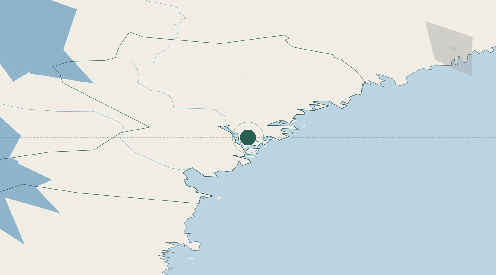
Nearby Logistics Neighbours

Cities
  1. 1Gustavsvik9 km
  2. 2Kramfors15 km
  3. 3Bollstabruk23 km
  4. 4Härnösand26 km
  5. 5Köpmanholmen43 km
Nearest neighbours — logibook spatial index (haversine) over the source coordinates
Ports
  1. 1Gustavsvik9 km
  2. 2Utansjo12 km
  3. 3Kramfors14 km
  4. 4Vaja21 km
  5. 5Bollstabruk23 km
Nearest neighbours — logibook spatial index (haversine) over the source coordinates
Airports
  1. 1Kramfors-Sollefteå Höga Kusten Airport24 km
  2. 2Sundsvall-Härnösand Airport48 km
  3. 3Örnsköldsvik Airport77 km
  4. 4Umeå Airport152 km
  5. 5Åre Östersund Airport182 km
Nearest neighbours — logibook spatial index (haversine) over the source coordinates
Trade Zones
  1. 1Turku Free Zone348 km
  2. 2Stockholm Free Zone391 km
  3. 3Freeport of Hanko425 km
  4. 4Oulu Port Free Warehouse Area431 km
  5. 5Paldiski Free Zone509 km
Nearest neighbours — logibook spatial index (haversine) over the source coordinates
DatabookThe Record of Consolidated Knowledge
Sweden beyond logistics?
Browse databook

All Sources

LocationsUN/LOCODE
UN/LOCODE — free
Portsthe NGA World Port Index
Public domain (US gov)
AirportsOurAirports
Public domain
Trade Zonesthe World Bank SEZ database
CC BY 4.0
Trade ZonesOpen Zone Map
CC BY
← Sweden locations