UN/LOCODE hub · Philippines
PHPLL

Polillo, Polillo Isl

14.7000°, 121.9333°
2
Transport functions

Transport Functions

Port
Road
UN/LOCODE

Hub Profile

Region
QUE
GeoNames

Location

Location of PHPLL
Natural Earth 10m (public domain) · QUE · PHPLL · 14.70, 121.93GoogleOSMYandex

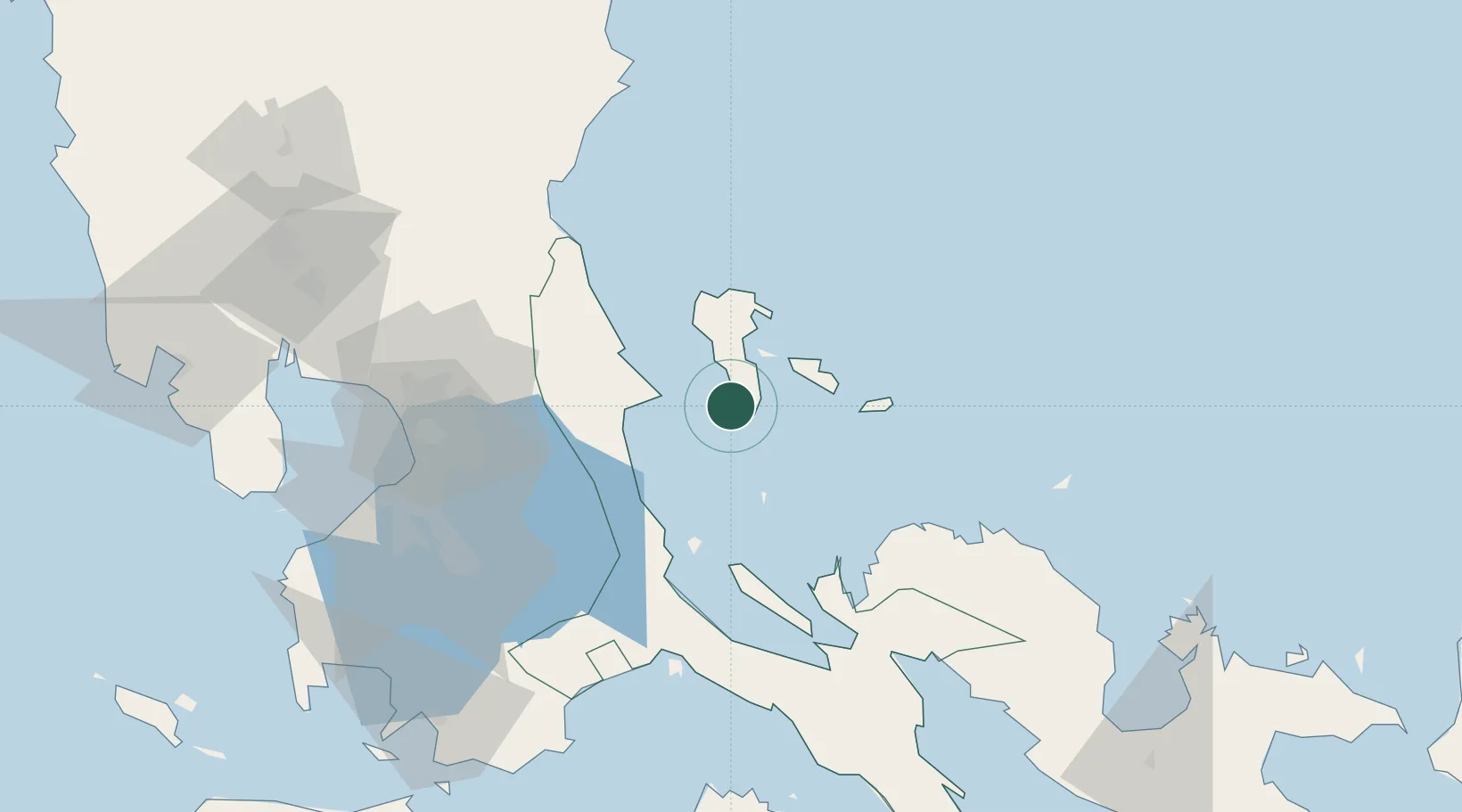
Nearby Logistics Neighbours

Cities
  1. 1Burdeos, Polillo Isl15 km
  2. 2Taguig32 km
  3. 3Binan61 km
  4. 4Atimonan/Siain80 km
  5. 5Pagbilao86 km
Nearest neighbours — logibook spatial index (haversine) over the source coordinates
Ports
  1. 1Hondagua89 km
  2. 2Jose Panganiban93 km
  3. 3Manila105 km
  4. 4Batangas City142 km
  5. 5Nasugbu158 km
Nearest neighbours — logibook spatial index (haversine) over the source coordinates
Airports
  1. 1Ninoy Aquino International Airport101 km
  2. 2Danilo Atienza Air Base113 km
  3. 3Dr. Juan C. Angara Airport124 km
  4. 4Daet Airport129 km
  5. 5Marinduque Airport149 km
Nearest neighbours — logibook spatial index (haversine) over the source coordinates
Trade Zones
  1. 1Alphaland Balesin Island Resort33 km
  2. 2Tanay Rizal I.T. Park73 km
  3. 3Filinvest Technology Park Teresa81 km
  4. 4Eastbay Arts, Recreational and Tourism Zone84 km
  5. 5ATN Industrial Technology City86 km
Nearest neighbours — logibook spatial index (haversine) over the source coordinates
DatabookThe Record of Consolidated Knowledge
Philippines beyond logistics?
Browse databook

All Sources

LocationsUN/LOCODE
UN/LOCODE — free
Portsthe NGA World Port Index
Public domain (US gov)
AirportsOurAirports
Public domain
Trade Zonesthe World Bank SEZ database
CC BY 4.0
Trade ZonesOpen Zone Map
CC BY
← Philippines locations