UN/LOCODE hub · Philippines
PHENI

El Nido/Puerto Princesa

11.1833°, 119.4000°
3
Transport functions

Transport Functions

Port
Road
Airport
UN/LOCODE

Location

Location of PHENI
Natural Earth 10m (public domain) · Palawan · PHENI · 11.18, 119.40GoogleOSMYandex

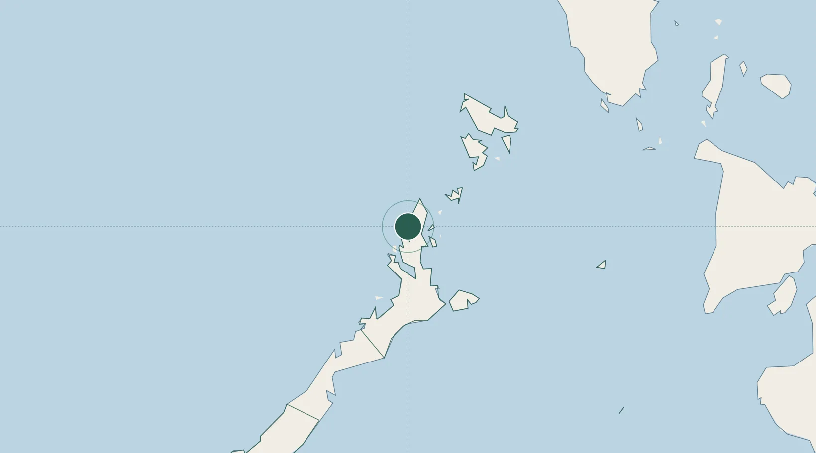
Nearby Logistics Neighbours

Cities
  1. 1Tindalo Oil Field56 km
  2. 2San Jose Apt, Mindoro225 km
  3. 3Semirara239 km
  4. 4Batonbaton250 km
  5. 5Hamtic285 km
Nearest neighbours — logibook spatial index (haversine) over the source coordinates
Ports
  1. 1Puerto Princesa177 km
  2. 2Calapan315 km
  3. 3Batangas City337 km
  4. 4Nasugbu348 km
  5. 5Port Romblon349 km
Nearest neighbours — logibook spatial index (haversine) over the source coordinates
Airports
  1. 1El Nido Airport3 km
  2. 2San Vicente Airport75 km
  3. 3Francisco B. Reyes (Busuanga) Airport129 km
  4. 4Puerto Princesa International Airport / PAF Antonio Bautista Air Base175 km
  5. 5Cuyo Airport186 km
Nearest neighbours — logibook spatial index (haversine) over the source coordinates
Trade Zones
  1. 1Green Tourism Ecozone - Cadlao1 km
  2. 2Green Tourism Ecozone - Miniloc10 km
  3. 3Green Tourism Ecozone - Lagen11 km
  4. 4Green Tourism Ecozone - Pangulasian11 km
  5. 5Green Tourism Ecozone -Pangulasian11 km
Nearest neighbours — logibook spatial index (haversine) over the source coordinates
DatabookThe Record of Consolidated Knowledge
Philippines beyond logistics?
Browse databook

All Sources

LocationsUN/LOCODE
UN/LOCODE — free
Portsthe NGA World Port Index
Public domain (US gov)
AirportsOurAirports
Public domain
Trade Zonesthe World Bank SEZ database
CC BY 4.0
Trade ZonesOpen Zone Map
CC BY
← Philippines locations