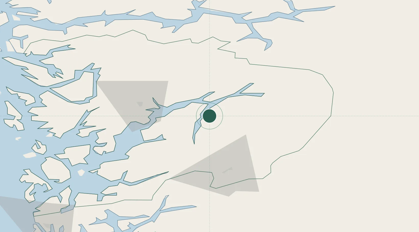
UN/LOCODE hub · Norway
NOULL

Ullensvang

60.3167°, 6.6500°
1
Transport functions

Transport Functions

Port
UN/LOCODE

Hub Profile

Place type
Locality
GeoNames
Region
Vestland
GeoNames
Time zone
Europe/Oslo
GeoNames
Elevation
80 m
GeoNames

Location

Location of NOULL
Natural Earth 10m (public domain) · Vestland · NOULL · 60.32, 6.65GoogleOSMYandex

Nearby Logistics Neighbours

Cities
  1. 1Kinsarvik7 km
  2. 2Hovland9 km
  3. 3Utne12 km
  4. 4Ålvik17 km
  5. 5Kvanndal19 km
Nearest neighbours — logibook spatial index (haversine) over the source coordinates
Ports
  1. 1Odda25 km
  2. 2Norheimsund28 km
  3. 3Vaksdal54 km
  4. 4Husnes69 km
  5. 5Bergen75 km
Nearest neighbours — logibook spatial index (haversine) over the source coordinates
Airports
  1. 1Bergen Airport, Flesland79 km
  2. 2Stord Airport, Sørstokken93 km
  3. 3Sogndal Airport, Haukåsen97 km
  4. 4Førde Airport, Bringeland129 km
  5. 5Haugesund Airport, Karmøy135 km
Nearest neighbours — logibook spatial index (haversine) over the source coordinates
Trade Zones
  1. 1Gothenburg Boundless Customs Warehouse414 km
  2. 2Jönköping Free Zone511 km
  3. 3Freeport of Copenhagen- Nordhavn620 km
  4. 4MTS Malmö Transport and Spedition647 km
  5. 5Freeport of Kiel698 km
Nearest neighbours — logibook spatial index (haversine) over the source coordinates
DatabookThe Record of Consolidated Knowledge
Norway beyond logistics?
Browse databook

All Sources

LocationsUN/LOCODE
UN/LOCODE — free
Portsthe NGA World Port Index
Public domain (US gov)
AirportsOurAirports
Public domain
Trade Zonesthe World Bank SEZ database
CC BY 4.0
Trade ZonesOpen Zone Map
CC BY
← Norway locations