UN/LOCODE hub · Norway
NOKSY

Kvitsøy

59.0500°, 5.4167°
1
Transport functions

Transport Functions

Port
UN/LOCODE

Hub Profile

Region
11
GeoNames

Location

Location of NOKSY
Natural Earth 10m (public domain) · 11 · NOKSY · 59.05, 5.42GoogleOSMYandex

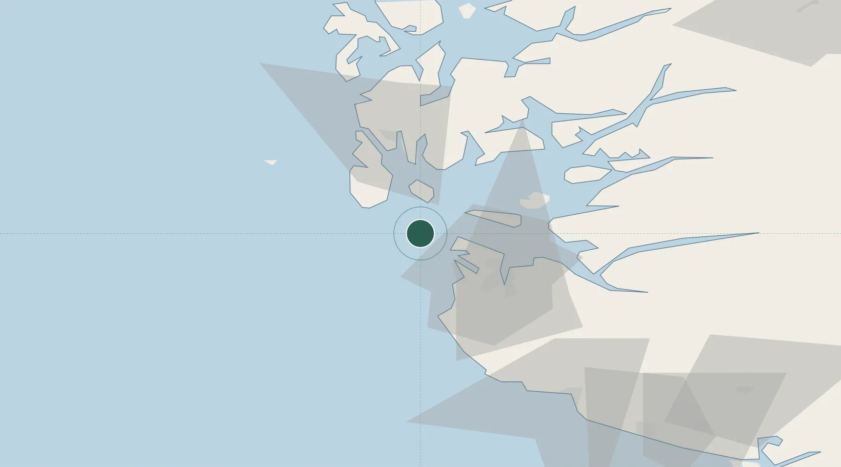
Nearby Logistics Neighbours

Cities
  1. 1Skudeneshavn13 km
  2. 2Randaberg14 km
  3. 3Dusavik15 km
  4. 4Rennesøy16 km
  5. 5Risavika17 km
Nearest neighbours — logibook spatial index (haversine) over the source coordinates
Ports
  1. 1Skudeneshavn14 km
  2. 2Tananger16 km
  3. 3Stavanger21 km
  4. 4Karsto25 km
  5. 5Kopervik27 km
Nearest neighbours — logibook spatial index (haversine) over the source coordinates
Airports
  1. 1Stavanger Airport, Sola23 km
  2. 2Haugesund Airport, Karmøy35 km
  3. 3Stord Airport, Sørstokken83 km
  4. 4Bergen Airport, Flesland139 km
  5. 5Kristiansand Airport181 km
Nearest neighbours — logibook spatial index (haversine) over the source coordinates
Trade Zones
  1. 1Gothenburg Boundless Customs Warehouse402 km
  2. 2Freeport of Kiel599 km
  3. 3Freeport of Cuxhaven (Freihafen Cuxhaven)612 km
  4. 4North Eastern Enterprise Zone622 km
  5. 5Tees Valley Enterprise Zone637 km
Nearest neighbours — logibook spatial index (haversine) over the source coordinates
DatabookThe Record of Consolidated Knowledge
Norway beyond logistics?
Browse databook

All Sources

LocationsUN/LOCODE
UN/LOCODE — free
Portsthe NGA World Port Index
Public domain (US gov)
AirportsOurAirports
Public domain
Trade Zonesthe World Bank SEZ database
CC BY 4.0
Trade ZonesOpen Zone Map
CC BY
← Norway locations