UN/LOCODE hub · Norway
NOHRS

Harøysundet

62.8833°, 6.9500°
2
Transport functions

Transport Functions

Port
Road
Harøysundet is also a profiled seaport →
UN/LOCODE

Hub Profile

Region
15
GeoNames

Location

Location of NOHRS
Natural Earth 10m (public domain) · 15 · NOHRS · 62.88, 6.95GoogleOSMYandex

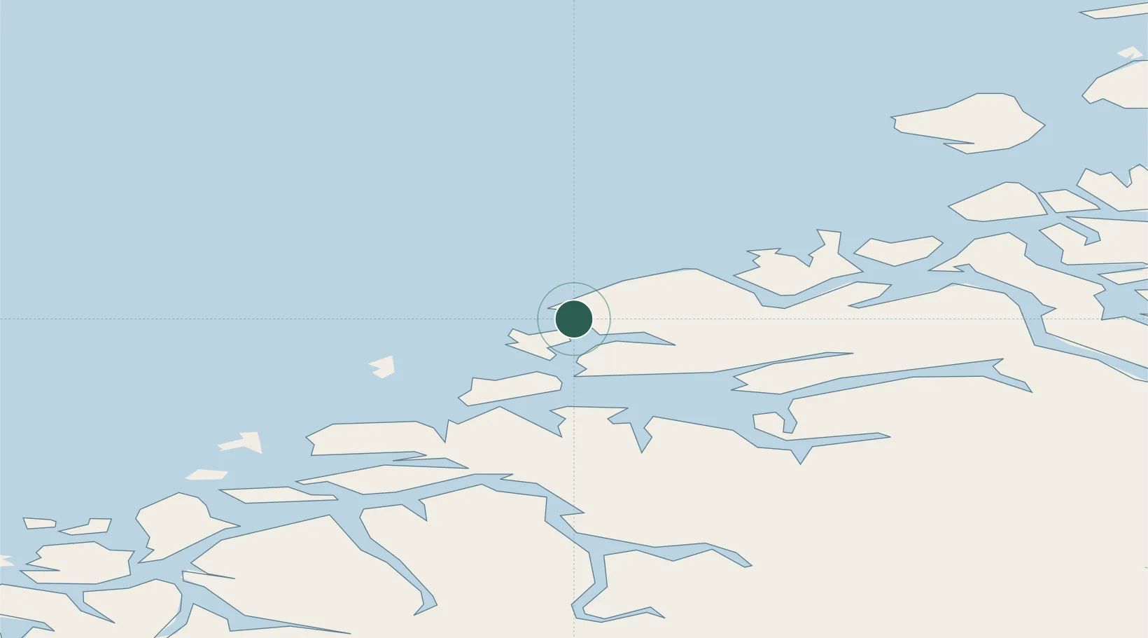
Nearby Logistics Neighbours

Cities
  1. 1Nyhamna4 km
  2. 2Aukra8 km
  3. 3Elnesvågen10 km
  4. 4Molde20 km
  5. 5Ramsvika24 km
Nearest neighbours — logibook spatial index (haversine) over the source coordinates
Ports
  1. 1Molde20 km
  2. 2Kristiansund47 km
  3. 3Andalsnes51 km
  4. 4Alesund61 km
  5. 5Hareid74 km
Nearest neighbours — logibook spatial index (haversine) over the source coordinates
Airports
  1. 1Molde Airport, Årø22 km
  2. 2Kristiansund Airport, Kvernberget51 km
  3. 3Ålesund Airport56 km
  4. 4Ørsta-Volda Airport, Hovden90 km
  5. 5Sandane Airport, Anda125 km
Nearest neighbours — logibook spatial index (haversine) over the source coordinates
Trade Zones
  1. 1Gothenburg Boundless Customs Warehouse635 km
  2. 2Jönköping Free Zone691 km
  3. 3Freeport of Copenhagen- Nordhavn859 km
  4. 4MTS Malmö Transport and Spedition881 km
  5. 5Freeport of Kiel969 km
Nearest neighbours — logibook spatial index (haversine) over the source coordinates
DatabookThe Record of Consolidated Knowledge
Norway beyond logistics?
Browse databook

All Sources

LocationsUN/LOCODE
UN/LOCODE — free
Portsthe NGA World Port Index
Public domain (US gov)
AirportsOurAirports
Public domain
Trade Zonesthe World Bank SEZ database
CC BY 4.0
Trade ZonesOpen Zone Map
CC BY
← Norway locations