UN/LOCODE hub · Croatia
HRLPR

Lopar

44.8333°, 14.8000°
1,107
Population
2
Transport functions

Transport Functions

Port
Road
UN/LOCODE

Hub Profile

Place type
Provincial seat
GeoNames
Region
Primorje-Gorski Kotar
GeoNames
Population
1,107
GeoNames
Time zone
Europe/Zagreb
GeoNames
Elevation
21 m
GeoNames

Location

Location of HRLPR
Natural Earth 10m (public domain) · Primorje-Gorski Kotar · HRLPR · 44.83, 14.80GoogleOSMYandex

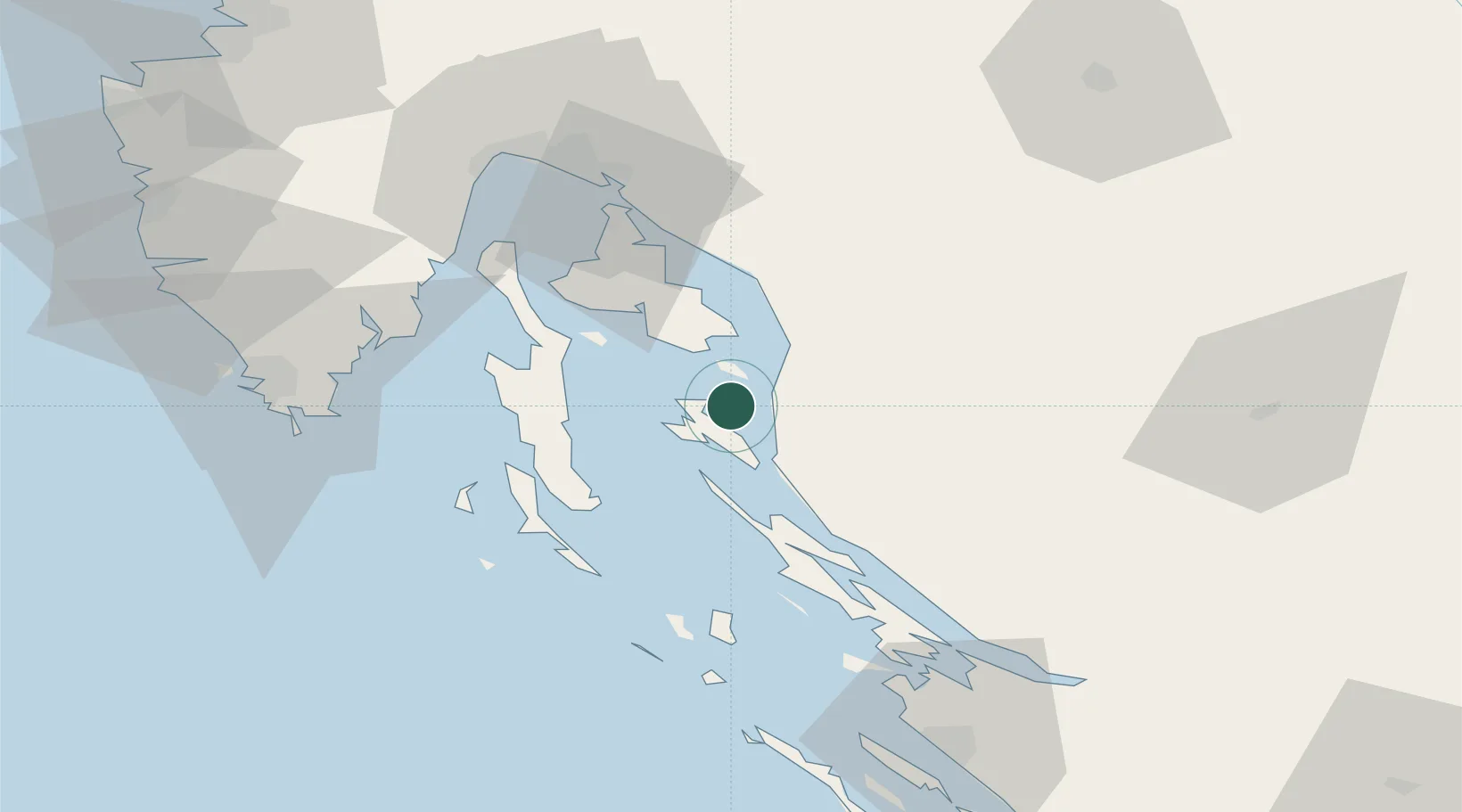
Nearby Logistics Neighbours

Cities
  1. 1Rab10 km
  2. 2Sveti Juraj14 km
  3. 3Jablanac15 km
  4. 4Baska15 km
  5. 5Misnjak16 km
Nearest neighbours — logibook spatial index (haversine) over the source coordinates
Ports
  1. 1Senj18 km
  2. 2Omisalj47 km
  3. 3Bakar56 km
  4. 4Zaliv Rasa63 km
  5. 5Rijeka Luka63 km
Nearest neighbours — logibook spatial index (haversine) over the source coordinates
Airports
  1. 1Rijeka Airport46 km
  2. 2Pula Airport70 km
  3. 3Udbina Airfield83 km
  4. 4Zadar Airport93 km
  5. 5Portorož Airport117 km
Nearest neighbours — logibook spatial index (haversine) over the source coordinates
Trade Zones
  1. 1Port of Rijeka Free Zone58 km
  2. 2Free Zone Kukuljanovo60 km
  3. 3Port of Pula Free Zone76 km
  4. 4Free Port of Trieste122 km
  5. 5PJ Free Zone Zagreb137 km
Nearest neighbours — logibook spatial index (haversine) over the source coordinates
DatabookThe Record of Consolidated Knowledge
Croatia beyond logistics?
Browse databook

All Sources

LocationsUN/LOCODE
UN/LOCODE — free
LocationsGeoNames
CC BY 4.0
Portsthe NGA World Port Index
Public domain (US gov)
AirportsOurAirports
Public domain
Trade Zonesthe World Bank SEZ database
CC BY 4.0
Trade ZonesOpen Zone Map
CC BY
← Croatia locations