UN/LOCODE hub · Croatia
HRBAS

Baska

44.9667°, 14.7500°
899
Population
2
Transport functions

Transport Functions

Port
Road
UN/LOCODE

Hub Profile

Place type
Provincial seat
GeoNames
Region
Primorje-Gorski Kotar
GeoNames
Population
899
GeoNames
Time zone
Europe/Zagreb
GeoNames
Elevation
10 m
GeoNames

Location

Location of HRBAS
Natural Earth 10m (public domain) · Primorje-Gorski Kotar · HRBAS · 44.97, 14.75GoogleOSMYandex

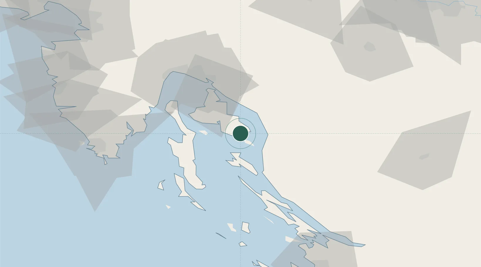
Nearby Logistics Neighbours

Cities
  1. 1Punat11 km
  2. 2Senj12 km
  3. 3Sveti Juraj14 km
  4. 4Vrbnik14 km
  5. 5Krk15 km
Nearest neighbours — logibook spatial index (haversine) over the source coordinates
Ports
  1. 1Senj12 km
  2. 2Omisalj32 km
  3. 3Bakar41 km
  4. 4Rijeka Luka48 km
  5. 5Zaliv Rasa55 km
Nearest neighbours — logibook spatial index (haversine) over the source coordinates
Airports
  1. 1Rijeka Airport31 km
  2. 2Pula Airport66 km
  3. 3Udbina Airfield93 km
  4. 4Portorož Airport105 km
  5. 5Zadar Airport108 km
Nearest neighbours — logibook spatial index (haversine) over the source coordinates
Trade Zones
  1. 1Free Zone Kukuljanovo45 km
  2. 2Port of Rijeka Free Zone46 km
  3. 3Port of Pula Free Zone73 km
  4. 4Free Port of Trieste109 km
  5. 5PJ Free Zone Zagreb128 km
Nearest neighbours — logibook spatial index (haversine) over the source coordinates
DatabookThe Record of Consolidated Knowledge
Croatia beyond logistics?
Browse databook

All Sources

LocationsUN/LOCODE
UN/LOCODE — free
LocationsGeoNames
CC BY 4.0
Portsthe NGA World Port Index
Public domain (US gov)
AirportsOurAirports
Public domain
Trade Zonesthe World Bank SEZ database
CC BY 4.0
Trade ZonesOpen Zone Map
CC BY
← Croatia locations