UN/LOCODE hub · Greece
GRYER

Yerakiní

40.2833°, 23.4500°
1
Transport functions

Transport Functions

Port
Yerakiní is also a profiled seaport →
UN/LOCODE

Hub Profile

Region
64
GeoNames

Location

Location of GRYER
Natural Earth 10m (public domain) · 64 · GRYER · 40.28, 23.45GoogleOSMYandex

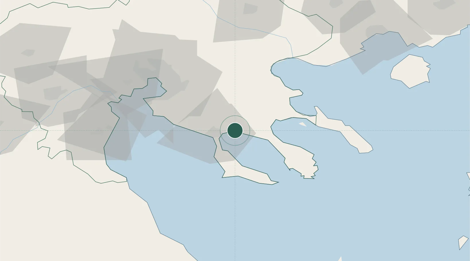
Nearby Logistics Neighbours

Cities
  1. 1Néa Moudhaniá15 km
  2. 2Néa Pláyia21 km
  3. 3Elaiokhória25 km
  4. 4Néa Kallikrátia33 km
  5. 5Ierissos38 km
Nearest neighbours — logibook spatial index (haversine) over the source coordinates
Ports
  1. 1Stratoni42 km
  2. 2Thessaloniki59 km
  3. 3Kavala108 km
  4. 4Volos111 km
  5. 5Tsingeli134 km
Nearest neighbours — logibook spatial index (haversine) over the source coordinates
Airports
  1. 1Thessaloniki Macedonia International Airport48 km
  2. 2Kavala Alexander the Great International Airport121 km
  3. 3Skiathos Island National Airport123 km
  4. 4Nea Anchialos National Airport131 km
  5. 5Kozani National Airport Filippos137 km
Nearest neighbours — logibook spatial index (haversine) over the source coordinates
Trade Zones
  1. 1Free Zone of Thessaloniki59 km
  2. 2TIDZ Gevgelija130 km
  3. 3TIDZ Strumica138 km
  4. 4TIDZ Berovo166 km
  5. 5TIDZ Radoviš171 km
Nearest neighbours — logibook spatial index (haversine) over the source coordinates
DatabookThe Record of Consolidated Knowledge
Greece beyond logistics?
Browse databook

All Sources

LocationsUN/LOCODE
UN/LOCODE — free
Portsthe NGA World Port Index
Public domain (US gov)
AirportsOurAirports
Public domain
Trade Zonesthe World Bank SEZ database
CC BY 4.0
Trade ZonesOpen Zone Map
CC BY
← Greece locations