UN/LOCODE hub · Greece
GRVTH

Port Vathý (Vathý)

37.7500°, 26.9833°
1
Transport functions

Transport Functions

Port
UN/LOCODE

Hub Profile

Region
84
GeoNames

Location

Location of GRVTH
Natural Earth 10m (public domain) · 84 · GRVTH · 37.75, 26.98GoogleOSMYandex

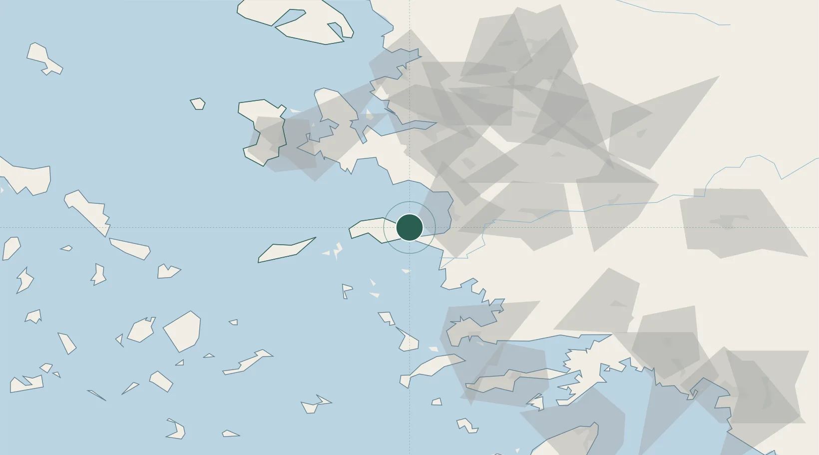
Nearby Logistics Neighbours

Cities
  1. 1Pythagóreion6 km
  2. 2Marathokampos Samou26 km
  3. 3Kusadasi26 km
  4. 4Néon Karlovásion27 km
  5. 5Agathonisi33 km
Nearest neighbours — logibook spatial index (haversine) over the source coordinates
Ports
  1. 1Samos2 km
  2. 2Pithagorion8 km
  3. 3Kusadasi27 km
  4. 4Neon Karlovas27 km
  5. 5Lakki70 km
Nearest neighbours — logibook spatial index (haversine) over the source coordinates
Airports
  1. 1Samos Airport9 km
  2. 2Ikaria Airport57 km
  3. 3Adnan Menderes International Airport62 km
  4. 4Leros Airport65 km
  5. 5Milas Bodrum International Airport82 km
Nearest neighbours — logibook spatial index (haversine) over the source coordinates
Trade Zones
  1. 1Aegean Free Zone67 km
  2. 2Tire Organized Industrial Zone76 km
  3. 3Izmir Ataturk Organized Industrial Zone83 km
  4. 4Izmir Free Zone97 km
  5. 5Manisa Organized Industrial Zone102 km
Nearest neighbours — logibook spatial index (haversine) over the source coordinates
DatabookThe Record of Consolidated Knowledge
Greece beyond logistics?
Browse databook

All Sources

LocationsUN/LOCODE
UN/LOCODE — free
Portsthe NGA World Port Index
Public domain (US gov)
AirportsOurAirports
Public domain
Trade Zonesthe World Bank SEZ database
CC BY 4.0
Trade ZonesOpen Zone Map
CC BY
← Greece locations