UN/LOCODE hub · Greece
GRMKP

Marathokampos Samou

37.7000°, 26.7000°
1
Transport functions

Transport Functions

Port
UN/LOCODE

Hub Profile

Region
84
GeoNames

Location

Location of GRMKP
Natural Earth 10m (public domain) · 84 · GRMKP · 37.70, 26.70GoogleOSMYandex

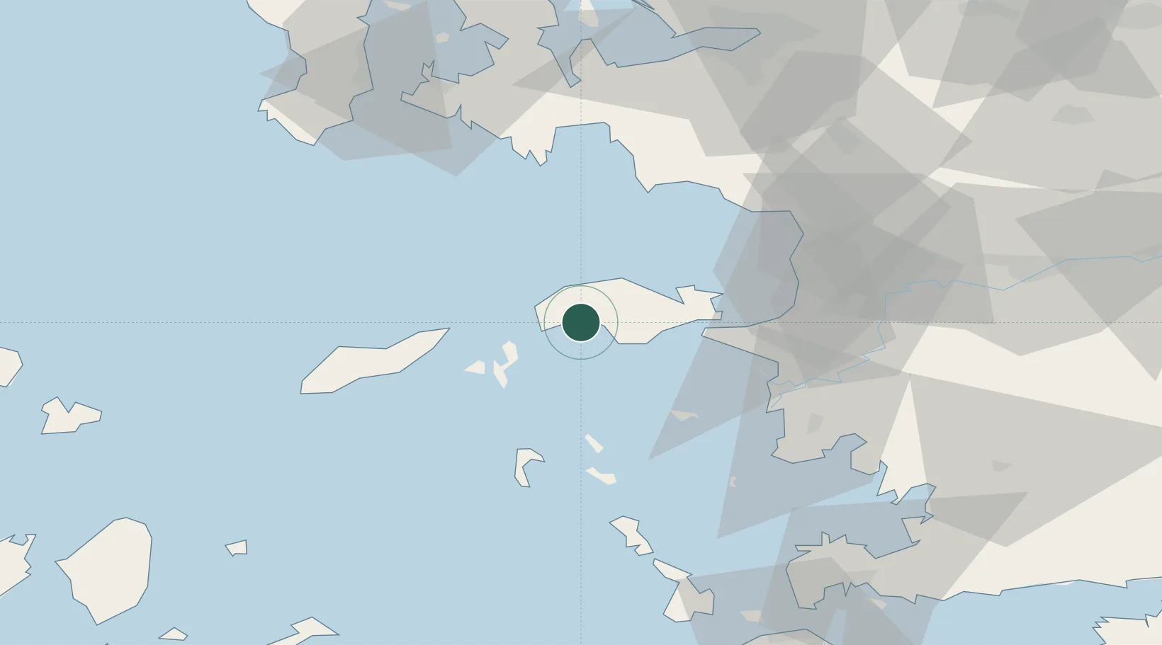
Nearby Logistics Neighbours

Cities
  1. 1Néon Karlovásion11 km
  2. 2Pythagóreion22 km
  3. 3Port Vathý (Vathý)26 km
  4. 4Thymaina Island26 km
  5. 5Foúrnoi28 km
Nearest neighbours — logibook spatial index (haversine) over the source coordinates
Ports
  1. 1Neon Karlovas11 km
  2. 2Pithagorion22 km
  3. 3Samos24 km
  4. 4Kusadasi52 km
  5. 5Lakki64 km
Nearest neighbours — logibook spatial index (haversine) over the source coordinates
Airports
  1. 1Samos Airport19 km
  2. 2Ikaria Airport31 km
  3. 3Leros Airport58 km
  4. 4Adnan Menderes International Airport77 km
  5. 5Kalymnos Airport85 km
Nearest neighbours — logibook spatial index (haversine) over the source coordinates
Trade Zones
  1. 1Aegean Free Zone80 km
  2. 2Izmir Ataturk Organized Industrial Zone93 km
  3. 3Tire Organized Industrial Zone100 km
  4. 4Izmir Free Zone104 km
  5. 5Manisa Organized Industrial Zone117 km
Nearest neighbours — logibook spatial index (haversine) over the source coordinates
DatabookThe Record of Consolidated Knowledge
Greece beyond logistics?
Browse databook

All Sources

LocationsUN/LOCODE
UN/LOCODE — free
Portsthe NGA World Port Index
Public domain (US gov)
AirportsOurAirports
Public domain
Trade Zonesthe World Bank SEZ database
CC BY 4.0
Trade ZonesOpen Zone Map
CC BY
← Greece locations