UN/LOCODE hub · Greece
GRVLC

Volissos (Limnia) Chios

38.4667°, 25.9167°
1
Transport functions

Transport Functions

Port
UN/LOCODE

Hub Profile

Region
85
GeoNames

Location

Location of GRVLC
Natural Earth 10m (public domain) · 85 · GRVLC · 38.47, 25.92GoogleOSMYandex

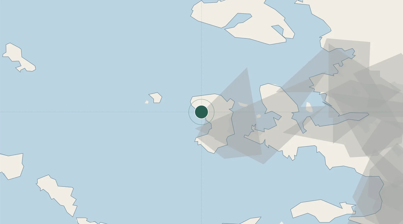
Nearby Logistics Neighbours

Cities
  1. 1Kardámyla18 km
  2. 2Mesta Hiou20 km
  3. 3Chíos22 km
  4. 4Inousses27 km
  5. 5Psará31 km
Nearest neighbours — logibook spatial index (haversine) over the source coordinates
Ports
  1. 1Khios22 km
  2. 2Plomarion70 km
  3. 3Mitilini90 km
  4. 4Nemrut Limani Bay93 km
  5. 5Aliaga97 km
Nearest neighbours — logibook spatial index (haversine) over the source coordinates
Airports
  1. 1Chios Island National Airport24 km
  2. 2Mytilene International Airport88 km
  3. 3Ikaria Airport95 km
  4. 4Çiğli Airbase95 km
  5. 5Adnan Menderes International Airport110 km
Nearest neighbours — logibook spatial index (haversine) over the source coordinates
Trade Zones
  1. 1Izmir Free Zone90 km
  2. 2Izmir Ataturk Organized Industrial Zone98 km
  3. 3Aegean Free Zone106 km
  4. 4Aliaga Kimya Ihtisas ve Karma Organized Industrial Zone106 km
  5. 5Manisa Organized Industrial Zone127 km
Nearest neighbours — logibook spatial index (haversine) over the source coordinates
DatabookThe Record of Consolidated Knowledge
Greece beyond logistics?
Browse databook

All Sources

LocationsUN/LOCODE
UN/LOCODE — free
Portsthe NGA World Port Index
Public domain (US gov)
AirportsOurAirports
Public domain
Trade Zonesthe World Bank SEZ database
CC BY 4.0
Trade ZonesOpen Zone Map
CC BY
← Greece locations