UN/LOCODE hub · Greece
GRSYM

Symi

36.6000°, 27.8333°
2,354
Population
1
Transport functions

Transport Functions

Port
UN/LOCODE

Hub Profile

Place type
District seat
GeoNames
Region
South Aegean
GeoNames
Population
2,354
GeoNames
Time zone
Europe/Athens
GeoNames
Elevation
4 m
GeoNames

Location

Location of GRSYM
Natural Earth 10m (public domain) · South Aegean · GRSYM · 36.60, 27.83GoogleOSMYandex

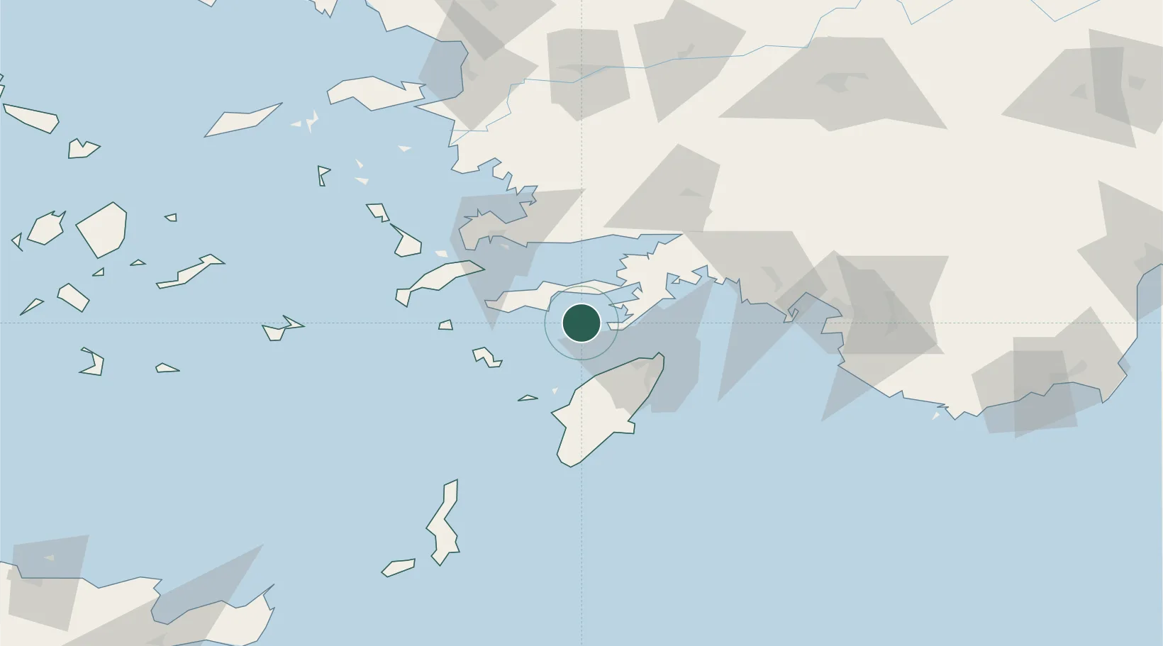
Nearby Logistics Neighbours

Cities
  1. 1Datça22 km
  2. 2Soroni30 km
  3. 3Hisarönü34 km
  4. 4Kamiros Skala37 km
  5. 5Içmeler40 km
Nearest neighbours — logibook spatial index (haversine) over the source coordinates
Ports
  1. 1Rodhos39 km
  2. 2Marmaris49 km
  3. 3Limin Kos59 km
  4. 4Bodrum60 km
  5. 5Gulluk75 km
Nearest neighbours — logibook spatial index (haversine) over the source coordinates
Airports
  1. 1Rhodes International Airport "Diagoras"31 km
  2. 2Kos International Airport "Ippokratis"70 km
  3. 3Milas Bodrum International Airport74 km
  4. 4Dalaman International Airport87 km
  5. 5Kalymnos Airport89 km
Nearest neighbours — logibook spatial index (haversine) over the source coordinates
Trade Zones
  1. 1Tire Organized Industrial Zone169 km
  2. 2Aegean Free Zone203 km
  3. 3Denizli Free Zone211 km
  4. 4Salihli Organized Industrial Zone217 km
  5. 5Izmir Ataturk Organized Industrial Zone222 km
Nearest neighbours — logibook spatial index (haversine) over the source coordinates
DatabookThe Record of Consolidated Knowledge
Greece beyond logistics?
Browse databook

All Sources

LocationsUN/LOCODE
UN/LOCODE — free
LocationsGeoNames
CC BY 4.0
Portsthe NGA World Port Index
Public domain (US gov)
AirportsOurAirports
Public domain
Trade Zonesthe World Bank SEZ database
CC BY 4.0
Trade ZonesOpen Zone Map
CC BY
← Greece locations