UN/LOCODE hub · Greece
GRDOS

Delos

37.4000°, 25.2667°
1
Transport functions

Transport Functions

Port
UN/LOCODE

Location

Location of GRDOS
Natural Earth 10m (public domain) · Notio Aigaio · GRDOS · 37.40, 25.27GoogleOSMYandex

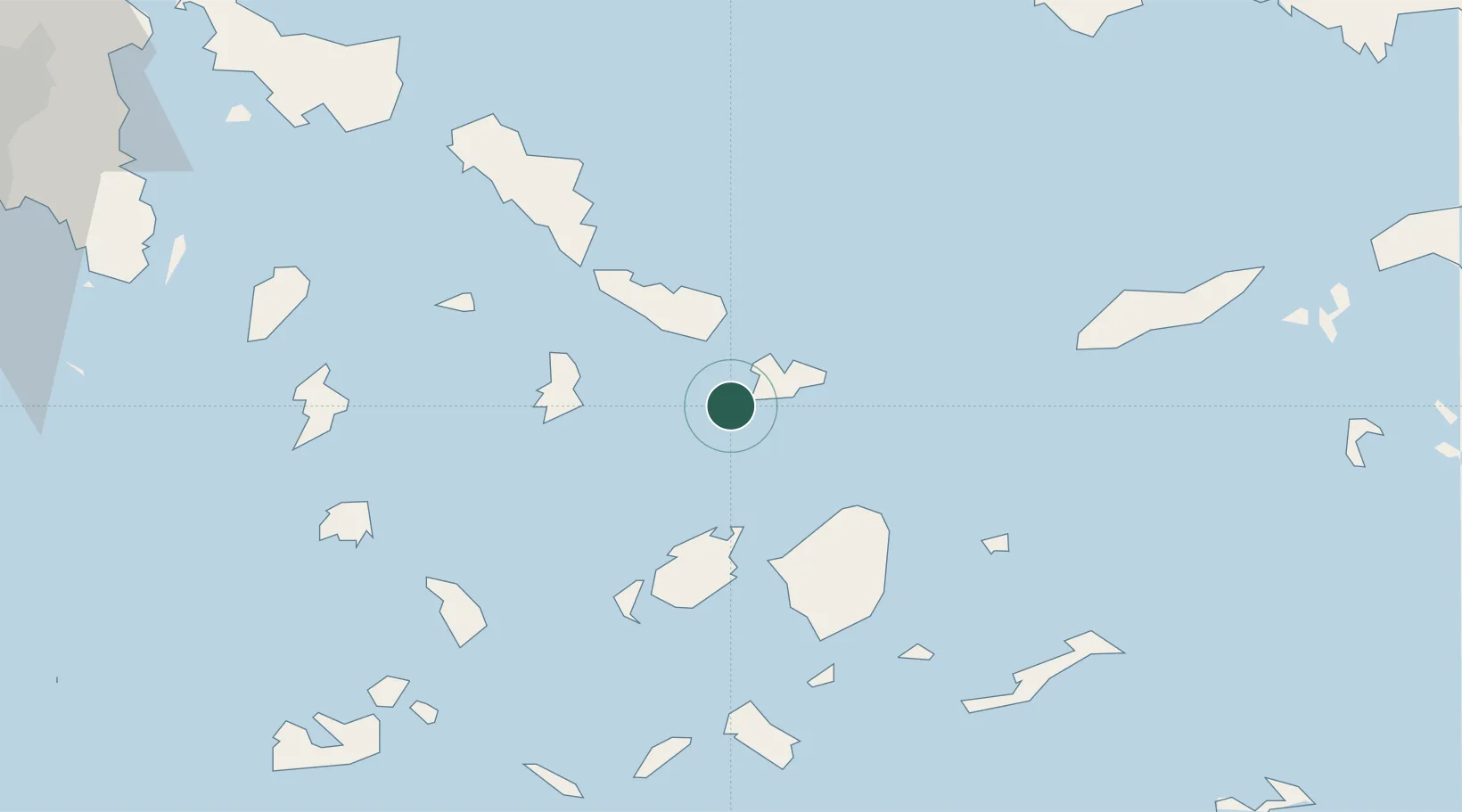
Nearby Logistics Neighbours

Cities
  1. 1Mykonos8 km
  2. 2Tínos17 km
  3. 3Naoussa Parou32 km
  4. 4Órmos Panórmou34 km
  5. 5Náxos35 km
Nearest neighbours — logibook spatial index (haversine) over the source coordinates
Ports
  1. 1Mikonos8 km
  2. 2Limin Sirou28 km
  3. 3Nisos Naxos35 km
  4. 4Andros56 km
  5. 5Gavrio71 km
Nearest neighbours — logibook spatial index (haversine) over the source coordinates
Airports
  1. 1Mykonos Island National Airport8 km
  2. 2Syros Airport28 km
  3. 3Naxos Island National Airport37 km
  4. 4Paros National Airport44 km
  5. 5Ikaria Airport100 km
Nearest neighbours — logibook spatial index (haversine) over the source coordinates
Trade Zones
  1. 1Free Zone of Piraeus158 km
  2. 2Aegean Free Zone194 km
  3. 3Izmir Ataturk Organized Industrial Zone197 km
  4. 4Izmir Free Zone199 km
  5. 5Aliaga Kimya Ihtisas ve Karma Organized Industrial Zone222 km
Nearest neighbours — logibook spatial index (haversine) over the source coordinates
DatabookThe Record of Consolidated Knowledge
Greece beyond logistics?
Browse databook

All Sources

LocationsUN/LOCODE
UN/LOCODE — free
Portsthe NGA World Port Index
Public domain (US gov)
AirportsOurAirports
Public domain
Trade Zonesthe World Bank SEZ database
CC BY 4.0
Trade ZonesOpen Zone Map
CC BY
← Greece locations