UN/LOCODE hub · Greece
GRGAP

Mandra Attikis

38.0667°, 23.5000°
1
Transport functions

Transport Functions

Multimodal
UN/LOCODE

Hub Profile

Region
A1
GeoNames

Location

Location of GRGAP
Natural Earth 10m (public domain) · A1 · GRGAP · 38.07, 23.50GoogleOSMYandex

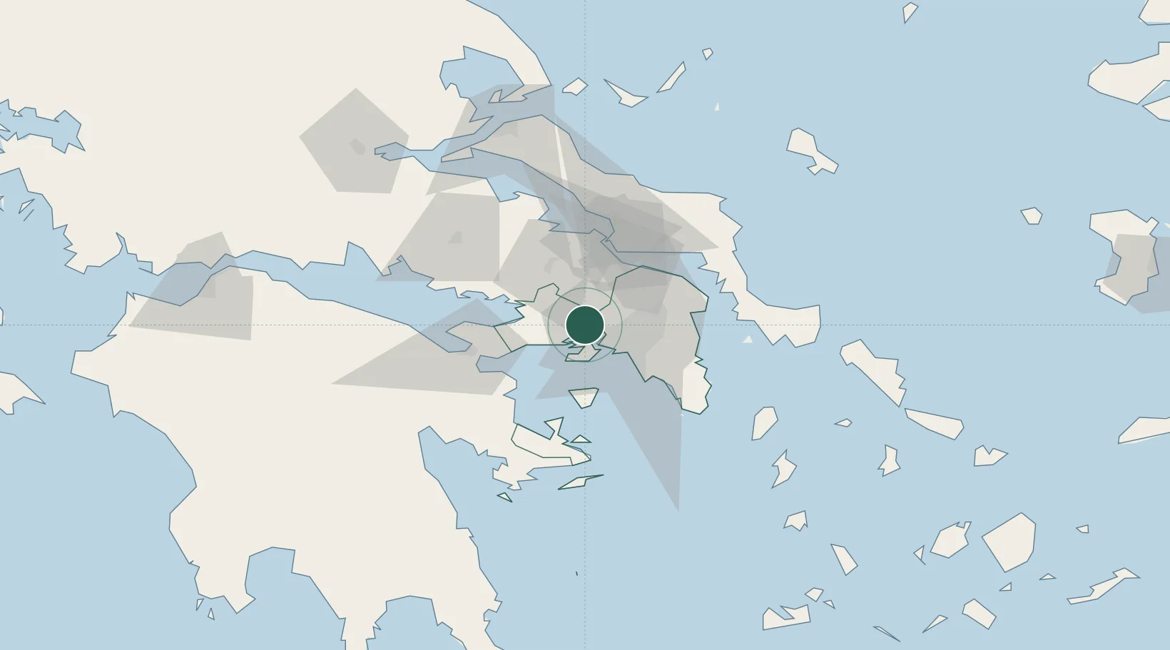
Nearby Logistics Neighbours

Cities
  1. 1Magoúla2 km
  2. 2Eleusina5 km
  3. 3Eleusis5 km
  4. 4Skaramangás10 km
  5. 5Salamís11 km
Nearest neighbours — logibook spatial index (haversine) over the source coordinates
Ports
  1. 1Megara Oil Terminal14 km
  2. 2Piraievs20 km
  3. 3Ormos Aliveriou60 km
  4. 4Lavrio64 km
  5. 5Navplio83 km
Nearest neighbours — logibook spatial index (haversine) over the source coordinates
Airports
  1. 1Elefsis Air Base5 km
  2. 2Tanagra Air Base31 km
  3. 3Athens Eleftherios Venizelos International Airport42 km
  4. 4Skiathos Island National Airport124 km
  5. 5Skiros Airport132 km
Nearest neighbours — logibook spatial index (haversine) over the source coordinates
Trade Zones
  1. 1Free Zone of Piraeus17 km
  2. 2Free Zone of Platigiali (Astakos Etoloakarnanias)214 km
  3. 3Free Zone of Thessaloniki290 km
  4. 4TIDZ Gevgelija359 km
  5. 5Përmet Freezone363 km
Nearest neighbours — logibook spatial index (haversine) over the source coordinates
DatabookThe Record of Consolidated Knowledge
Greece beyond logistics?
Browse databook

All Sources

LocationsUN/LOCODE
UN/LOCODE — free
Portsthe NGA World Port Index
Public domain (US gov)
AirportsOurAirports
Public domain
Trade Zonesthe World Bank SEZ database
CC BY 4.0
Trade ZonesOpen Zone Map
CC BY
← Greece locations